Redtop Mountain State Park –
Redtop Mountain State Park near Acworth is on 12,000 acre Lake Allatoona. There are more than 15 miles of trails winding through the forested park. The park is named for its red iron-rich soil. Trails descriptions Trails map Rave reviews from Yelp Phone 770-975-0055 Here is their website.
![]() Lakeside Trail 0.75 mile paved loop by Lake Altoona
Lakeside Trail 0.75 mile paved loop by Lake Altoona
Author: Cecilia
Panola State Park
Panola Mountain State Park
Panola Mountain, near Atlanta, is a 100-acre granite outcrop. This monadnock and its rare ecosystem is still pristine as it was known to Native Americans centuries ago. Panola Mountain State Park is part of the Arabia Mountain National Heritage Area. Trails Trail map and Guide Phone 770-389-7801 Here is their website.
![]() ? Outcrop Trail 0.75 mile was referred to as a “handicap access trail” in a now defunct guide. Call before you go to see if it is something you can do.
? Outcrop Trail 0.75 mile was referred to as a “handicap access trail” in a now defunct guide. Call before you go to see if it is something you can do.
There is a two mile self-guided nature trail and a 12 mile paved trail, which connects Panola Mountain with Arabia Mountain and Stonecrest Mall.
Moccasin Creek State Park
Moccasin Creek State Park –
On the shore of 2,800 acre lake Burton, Moccasin Creek has a fully accessible fishing pier which sits above a trout-filled creek open only to seniors 65 and older and children 11 and younger, as well as all ages with a Georgia disability fishing license. Although a mountain location, Moccasin Creek is relatively flat.
Phone 706-947-3194 Here is their website.
![]() Interpretive Trail 1 mile
Interpretive Trail 1 mile
Fort Yargo State Park
Fort Yargo State Park –
Fort Yargo in Winder east of Atlanta is a 1816-acre park featuring “… a 1792 log fort built by settlers for protection against Creek and Cherokee Indians. Today, visitors come to Fort Yargo for its wide variety of outdoor recreation and scenery.” There are 18 miles of hiking/biking trails, accessible cottages to rent and an accessible fishing dock.
Phone 770-867-3489 Here is their website. Trails Map
![]() Birdberry Trail 0.9 mile round trip paved Map
Birdberry Trail 0.9 mile round trip paved Map
Crooked River State Park
Crooked River State Park –
Crooked River State Park is on the southern tip of Georgia’s Colonial Coast, along the Intracoastal Waterway and in maritime forest. Campsites are surrounded by palmettos and live oaks, while cottages are set near the tidal river. There is a boat ramp.
A nature trail “winds through forest and salt marsh, and hikers may see gopher tortoises, fiddler crabs, herons and other birds. A nature center features fish, snakes, turtles and other animals native to coastal Georgia.” Trail Map
Trails descriptions Phone 912-882-5256 Here is their website.
![]() There are several short nature trails described in the website, which sound as if they would be easy walking, but there is no indication of wheelchair accessibility.
There are several short nature trails described in the website, which sound as if they would be easy walking, but there is no indication of wheelchair accessibility.
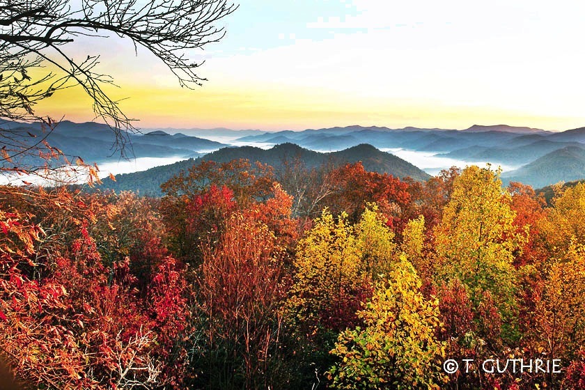
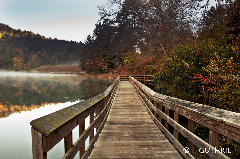
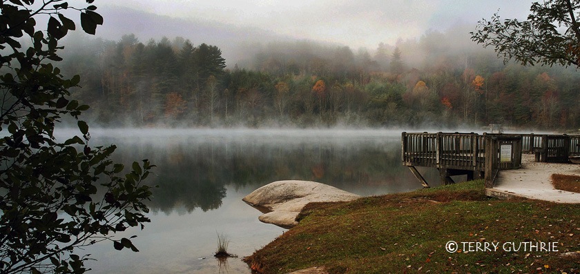
Black Rock Mountain State Park
Black Rock Mountain State Park is in Rabun County, northeast Georgia. Terry Guthrie sent these photos. He writes, “The park has two accessible overlooks on the way to the visitor’s center, and the visitor’s center itself provides good views.” I am putting more of Terry’s photos in the Photography page. Trail Map Park phone 706-746-2141 Here is their website.
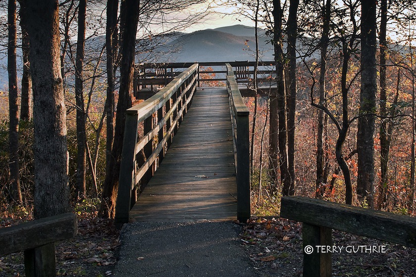
![]() Black Rock Lake in Black Rock Mountain State Park. The trail around the lake is .8 mile long and is rated easy. Thank you to Rex Matthews, who wrote that “There is no nearby handicapped parking access, the trail is flat but not paved or surfaced, and they prefer that people not try to take wheelchairs on it due to rutting, etc.”
Black Rock Lake in Black Rock Mountain State Park. The trail around the lake is .8 mile long and is rated easy. Thank you to Rex Matthews, who wrote that “There is no nearby handicapped parking access, the trail is flat but not paved or surfaced, and they prefer that people not try to take wheelchairs on it due to rutting, etc.”
Amicalola Falls State Park
Amicalola Falls State Park
Amicalola Falls State Park 15 miles northwest of Dawsonville, is a 829 acre park. The Amicalola waterfalls drop 729′ in seven cascades making them the highest waterfall east of the Mississippi River. There are several hiking trails, including access to the Appalachian Trail.
Here is their website. Phone 706-265-4703. Trail Map
![]() West Ridge Falls Access Trail – 0.3 miles in length. Rated easy to moderate. Wheelchair accessible with gentle slope. One of the best views of the falls and one of the easier trails. Trail surface is flat and coated with recycled tires.
West Ridge Falls Access Trail – 0.3 miles in length. Rated easy to moderate. Wheelchair accessible with gentle slope. One of the best views of the falls and one of the easier trails. Trail surface is flat and coated with recycled tires.
![]() Lodge Loop – 0.25 mile loop. Rated easy. Wheelchair accessible. Paved surface with educational displays. Trail is lighted for early morning and/or evening use.”
Lodge Loop – 0.25 mile loop. Rated easy. Wheelchair accessible. Paved surface with educational displays. Trail is lighted for early morning and/or evening use.”
Accommodations, Activities and Accessibility of Georgia State Parks
The State of Georgia makes available this PDF chart addressing accommodations, activities, and accessibility of Georgia State Parks.
There are ADA Assessments for all of Georgia Parks trails. “These accessibility assessments are maintained at each state park and historic site where the trails are located and are available for review and/or can be provided electronically by directly contacting the state park or historic site office. For further information, contact Larry Blankenship at 404-656-6524.”
NE Georgia Mountains ADA Accessible Outdoor Places
A mixture of locations are described at the website NE Georgia Mountains ADA Accessible Outdoor Places to Visit
Rails-to-Trails – Florida
The Rails-to-Trails Conservancy lists wheelchair accessible trails in Florida.