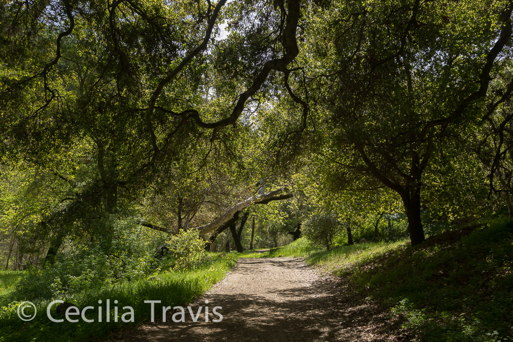
California has a number of trails with minimal obstacles. Some are very easy and others are wheelchair accessible. Here are just a few of them.
Most of the links given were found through Internet search. Some places I have been able to visit and a few have been recommended to me by other people who have been there. With your help, we can share our knowledge with disabled people everywhere and also increase awareness of the need for more accessibility. Please e-mail me with your suggestions using the form in the sidebar.
Federal
State
Local
Private
Miscellaneous
Federal
Golden Gate National Recreation Area
The park has many interesting sites to visit including Alcatraz Island, Muir Woods National Monument, Fort Point National Historic Site, the Marin Headlands,
Here is their website and their page regarding accessibility. Map and Brochure Phone 415-561-4700

Muir Woods has an accessible boardwalk for several hundred feet to Founders Grove. “…past the boardwalk you will encounter an asphalt trail which is usable; however, it contains potholes and severe cracks due to heaving tree roots. As funding and resources allow, we will continue to replace the existing asphalt with an accessible raised boardwalk.” Muir Woods Brochure is available in Braille. Accessibility at Muir Woods.
The photo is courtesy of Mark Hehir, who writes that San Francisco’s Crissy Field has “several handicap parking spots, and you have a wonderful view of the Golden Gate Bridge, and of Alcatraz Island.”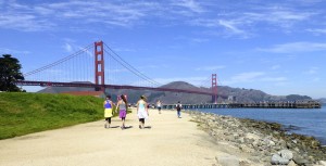
Wheelchair accessible path by Golden Gate Bridge from Crissy Field, San Francisco, CA ©Mark Hehir 2014 Inyo National Forest
Inyo National Forest in the Eastern Sierra of California has some easy and some accessible trails and boardwalks such as the Nunatak Tioga Tarns Trail and the Convict Lake Loop Trail. Thanks to Debra Schweizer for letting me know about them. The 1,903,381 acre Inyo National Forest includes many of California’s iconic locations such as Mt. Whitney, Mono Lake, Mammoth Lakes, the John Muir Wilderness, and the Ancient Bristlecone Pine Forest.
Phone 760-873-2400 Here is their website. Visitor GuideMono Lake Ranger District
 ? Nunatak Tioga Tarns Trail 0.5 mile There are interpretive signs along this trail. Ms Schweizer writes that it may have been ADA compliant when it was originally built but has not been maintained. She has seen wheelchair users on it, but they had assistance.
Mono Lake Boardwalk, South Tufa 0.7 mile easy boardwalk through the tufas. From the photos it looks narrow for wheelchairs, but call the Visitor Center for information 760-647-3044 See also Mono Lake State Natural Reserve under the State listings on this page.Mammoth Ranger District
Convict Lake East Shore Trail a short paved nature trail from the outflow of Convict Lake to the picnic area at the base of Mt. Morrison.
Ms Schweizer mentions the bike trails at Mammoth Lakes area. Here is a link to descriptions of these paved, “family friendly” biking trails.White Mountain Ranger District.
Schulman Grove Visitor Center in the Ancient Bristlecone Pine Forest. Ms Schweizer writes that there is a short boardwalk that gives access to the visitor center and has displays about the ancient trees.Know more about Inyo National Forest?
Have you visited this location and know of more accessible or easy trails? Is any of the information given here incorrect? If so, please contact me using the form to the left and let me know what should be changed or added so I can update this post.Lassen Volcanic National Park
Lassen Volcanic National Park has a paved accessible interpretive trail. The hydrothermal features in Lassen Volcanic National Park include “roaring fumaroles (steam and volcanic-gas vents), thumping mud pots, boiling pools, and steaming ground.” There are jagged peaks, mountain lakes, and meadows of wildflowers.
Here is the accessibility page for Lassen Volcanic NP and here a PDF of their Accessibility Guide. Map Phone 530-595-4480 Here is the park website.
There is a half mile paved interpretive trail in the Devastated Area. The “easy, flat nature trail loops around a small section of the Devastated Area. Displays placed along the way explain various features of this area, flattened by the eruptions of Mount Lassen between 1914 and 1917. Excellent views of Lassen itself can be seen all along the trail as well.”Know more about Lassen Volcanic National Park?
Have you visited this location and know of more accessible or easy trails? Is any of the information given here incorrect? If so, please contact me using the form to the left and let me know what should be changed or added so I can update this post.Mendocino National Forest
The Mendocino National Forest has a couple of accessible trails at Chico Seed Orchard. The Orchard produces plants for a wide variety of projects ranging from reforestation and mine reclamation to biological, chemical, and clinical research on anti-cancer drugs derived from plants. The Mendocino is uncrossed by paved roads. Its elevation goes from 750 feet in the Grindstone Creek Canyon in the Sacramento Valley foothills on the Forest’s eastern edge to the 8092 feet of South Yolla Bolly Mountain in the northern part of the Forest.
Accessible Recreation Possibilities Phone 530-934-3316 Here is their website.Chico Seed Orchard
Comanche Trail 1 mile loop in “The 3/4 mile hard surface trail winds through mixed stands of mature trees with walk bridges crossing small stream beds.”
Self-guiding nature trail: 1 mile loop “meanders through a unique botanical area in Edgar Slough which has remnants of exotic species that were planted when this was a Plant Introduction Center.Know more about Mendocino National Forest?
Have you visited this location and know of more accessible or easy trails? Is any of the information given here incorrect? If so, please contact me using the form to the left and let me know what should be changed or added so I can update this post.Piedras Blancas Light Station
The beaches near the Piedras Blancas lighthouse, north of San Simeon, California attract thousands of elephant seals.
There are accessible boardwalks from which you can see and photograph the seals. The site is governed by the Bureau of Land Management. There is no fee for parking and viewing the seals. Here are reviews from Yelp and Trip Advisor. Phone for Friends of the Elephant Seal 805-924-1628 WebsiteThank you Cathy and Gordon Illg for the photograph!
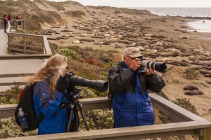
Photographing elephant seals from ADA wheelchair accessible boardwalk at Piedras Blancas Point © Cathy & Gordon Illg Plumas National Forest
The Plumas National Forest northeast of Chico, California has many easy trails and a couple of accessible ones. However, remember that a trail designated as “easy” may not be easy enough for you. Visitors to the Plumas National Forest enjoy its “many streams and lakes, beautiful deep canyons, rich mountain valleys, meadows, and lofty peaks.” The Forest is divided into three Ranger Districts. Call before heading out to determine trail conditions.
Phone 530-283-2050 Here is the Forest website.Beckwourth Ranger District phone 530-836-2575 Trail Descriptions.
Fern Falls Overlook 0.1mile On the Gold Lake Hwy. The trail crosses Gray Eagle Creek and leads to a scenic overlook near Fern Falls.
Grassy Lake Trail 0.8 mile leads past Grassy Lake and crosses Gray Eagle Creek.
Frazier Falls 0.5 mile on the old Gold Lake road. A paved trail leads to a fenced scenic overlook of the 176 foot tall Frazier Falls. ” Individuals in wheelchairs may need assistance. Wheelchair rating difficult”
Red Fir Nature Trail 0.5 mile on the Mills Peak Lookout road. Signed trail interpreting the ecosystem within a red fir stand.
Big Cove Enabler 0.2 miles Leads from Big Cove Campground to the lake.Feather River Ranger District Phone (530) 534-6500 Trail Descriptions
Big Bald Rock – 0.5 mile one way. Near the town of Berry Creek.Little North Fork 2 miles one way. After the first 2 miles the trail becomes steep. 15 miles northeast of Brush Creek Work Center. The trail follows the Little North Fork River north towards the historic Robinson Mine but the trail no longer actually reaches Robinson Mine.Mt. Hough Ranger District Trail Descriptions
Yellow Creek Trail 1.4 miles Near the Ely Stamp Mill rest area, across from Belden, “…an enjoyable day hike that ends in a box canyon.”Know more about Plumas National Forest?
Have you visited this location and know of more accessible or easy trails? Is any of the information given here incorrect? If so, please contact me using the form to the left and let me know what should be changed or added so I can update this post.San Bernardino National Forest
The San Bernardino National Forest in Southern California has many easy and a few accessible trails. The 823,816 acre Forest includes five wilderness areas. There are district Ranger Offices at Fawnskin, Idyllwild, and Lytle Creek. Baron Flats and Mill Creek have Visitor Centers. Elevation ranges from 2,000′ to 11,499′.
Here is the Forest website. Headquarters are in San Bernardino, phone 909-382-2600 Visitors Guide AccessibilitySan Jacinto Ranger District, Idyllwild phone 909-382-2921
Ernie Maxwell Scenic Trail – 2.6 mile trail leaves from Humber Park. The trail starts at 6100 ft. elevation and crosses streams as it descends 600 ft. It is rated easy, but may not be easy for you. Call ahead to learn more.
Chaparral Neighborhood Trail 0.5 mile self guided nature trail. Said to be easy, but check with the Ranger Station first.Front Country Ranger District, Lytle Creek phone 909-382-2851
Native Plant Garden paved walkways through different local plant communities. No ADA rating, but this garden right behind the ranger station sounds likely.
Rio Monte Trail 2.5 miles “easy walk” Starts at Barton Flats Visitor Center. Check ahead 909-794-4861 to determine if this is easy enough for you.
Big Falls Trail 0.3 miles “easy walk” The trail goes to the highest waterfall in Southern California.Mountain Top Ranger District, Fawnskin phone 909-382-2790
Lake Arrowhead area
Seeley Creek Trail 1 mile described as “gentle”. Trail crossed the creek and ends at a waterfall.
Heaps Peak Arboretum Trail 0.7 mile loop a self guided nature tour that is “easy for all ages”.
Trail of the Phoenix 0.5 mile loop “designed and maintained to accommodate the needs of the visually and physically disabled.”
Big Bear Valley
Alpine Pedal Path 2.5 miles one way asphalt path “connects the Big Bear Discovery Center with the Cougar Crest Trailhead and a pathway along the North shore of Big Bear Lake” “…this gentle trail has some magnificent views of the lake.”
Nature Discovery Trail 0.5 mile loop through the forest behind the Big Bear Discovery Center.
Woodland Trail 1.5 mile loop self guided interpretive trailChampion Lodgepole Pine Trail 0.3 mile one way along a small stream, ending at one of the largest known Lodgepole pines in California. You can continue another 0.4 mile on the Bluff Mesa Trail which is a “leisurely walk” through stands of Jeffrey Pine.Know more about San Bernardino National Forest?
Have you visited this location and know of more accessible or easy trails? Is any of the information given here incorrect? If so, please contact me using the form to the left and let me know what should be changed or added so I can update this post.Sequoia & Kings Canyon National Parks
The adjacent Sequoia and Kings Canyon National Parks in the southern Sierra Nevada of California have some accessible and easy trails. The parks include high mountains, rugged foothills, deep canyons, marble caverns, and the world’s largest trees. Elevations range from 1,300′ in the foothills to 14,491′ at the summit of Mt. Whitney. Much of the parks area is designated wilderness. The two parks are administered together by the National Park Service. Thank you Gary Rogers for bringing these parks to my attention.There are five visitor centers and a museum. Two of the visitor centers, Foothills and Kings Canyon, and the museum are open year around.
Here is the Parks’ website. Park phone 559-565-3341Cedar Grove area trails
Zumwalt Meadow 1.5-mile trail, some of it boardwalk. The trail “…passes high granite walls, lush meadows, and the Kings River.” Parts of this trail were washed out in early 2017, making it more difficult. Check with the visitor center.
Roaring River Falls paved “Relatively accessible” “…A very short, shady walk to a powerful waterfall rushing through a granite chute.”
? Mist Falls 3 of the first 4 miles to the falls are “relatively flat” but the last mile to the falls rises 600″.
Giant Forest and Lodgepole trails
General Sherman Tree. There is handicapped parking and an accessible trail two miles north of the Giant Forest Museum on the Generals Highway. The main trail is only 0.5 mile, but includes some stairs.
Big Trees Trail 0.66 mile paved loop starting at Giant Forest Museum.Grant Grove trails
General Grant Tree Trail 0.33 mile paved. Trail to one of the world’s largest living trees.
? North Grove Loop 1.5 mile through “…quiet walk past meadows and creeks, through mixed conifer and sequoia forest.”Yosemite National Park
The 1,200 square miles of Yosemite National Park include impressive waterfalls, deep valleys, grand meadows, ancient giant sequoias, and a vast wilderness area.
Here is the Park website. Accessibility Guide Phone Park Headquarters 209-372-0200 Accessibility Coordinator 209‐379‐1035
Yosemite Valley Here is a video of easy trails.
Lower Yosemite Falls Trail 1 mile paved “Consider walking the loop in a clockwise direction for best views of Yosemite Falls. This eastern portion of this loop trail is wheelchair accessible (when not covered in ice or snow).”
Bridalveil Fall Trail 0.5 mile paved The trail is considered too steep for wheelchairs.
Mirror Lake Trail 1 mile paved. Be sure to go in the spring when there is a lake and not just a meadow.
Cook’s Meadow Loop 1 mile “…short, easy walk offers stunning views of Yosemite Falls, Half Dome, Glacier Point, and Sentinel Rock.”
Wawona
Wawona Meadow Loop 3.5 milesWhite Wolf
? Lukens Lake from Tioga Road 1.6 miles round trip. “The trail winds through a mixed conifer forest, then over a saddle and down to a small mountain lake surrounded by a meadow.” Although this trail is rated “easy” you had better call first to learn about possible obstacles.
Tuolumne Meadows
Soda Springs and Parsons Lodge 1.5 miles Described in trailmob.com as “a great choice for hikers traveling with small children. ”
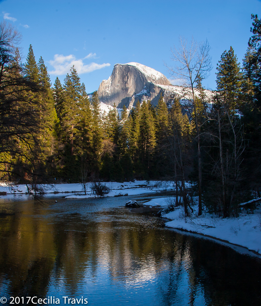
Half Dome, seen from accessible Sentinel Bridge, Yosemite National Park, CA


State
Accessibility within California’s State Parks Here is a list of accessible trails in California’s State Parks. You can arrange the list by region or alphabetically.
Calaveras Big Trees State Park
Calaveras Big Trees State Park preserves two groves of giant sequoias. The park is a mixed-conifer forest. In addition to the giant trees, you will find the Stanislaus River, Beaver Creek, ancient volcanic formations, and natural meadows. Phone 209-795-2334 Website Accessible features Park Brochure with Map Many thanks to Teddy Hall for bringing this park and its trails to our attention!
 Three Senses Trail is a 0.13 mile loop trail in a sequoia forest setting. There are rest stops and interpretive panels in English and Braille.
North Grove Trail is a 1.7 mile loop starting from the visitor center parking lot. Some of the largest trees in the park are along this trail.
Beaver Creek Trail is a 0.68 mile loop originating from the South Grove Parking lot and Beaver Creek Picnic area. There are scenic views along the Creek.
Stanislaus River Trail is 0.17 mile to the banks of the Stanislaus River. The trail starts near the River Picnic area.Henry Cowell Redwoods State Park
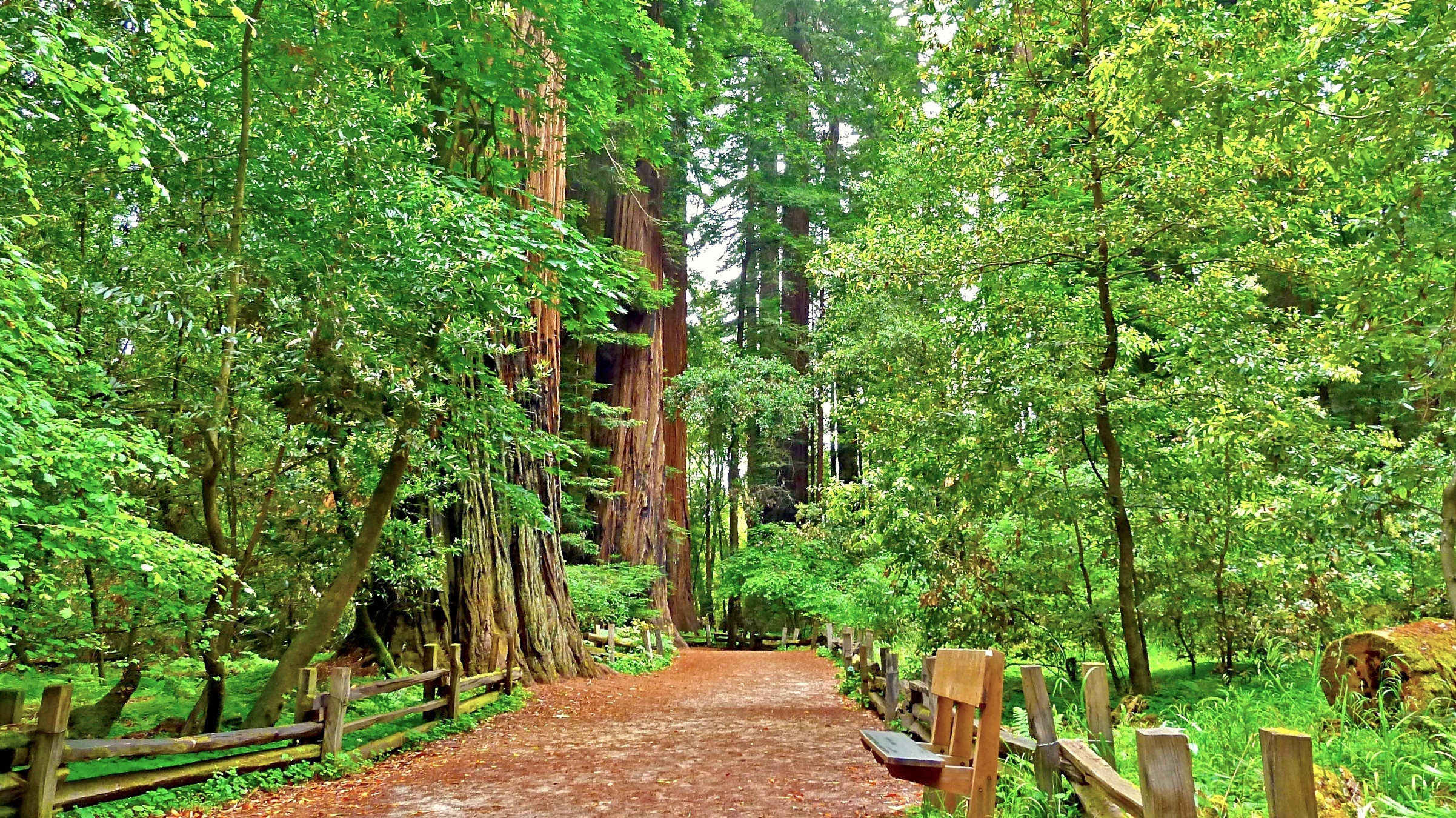
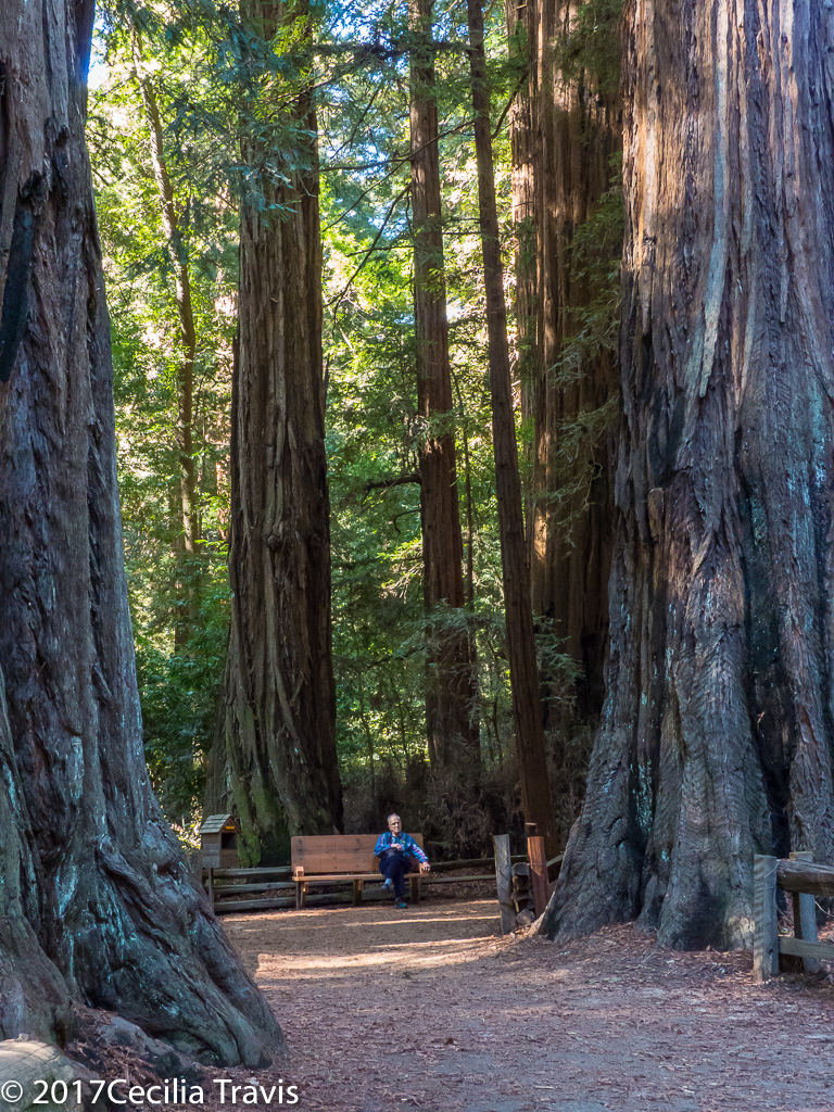
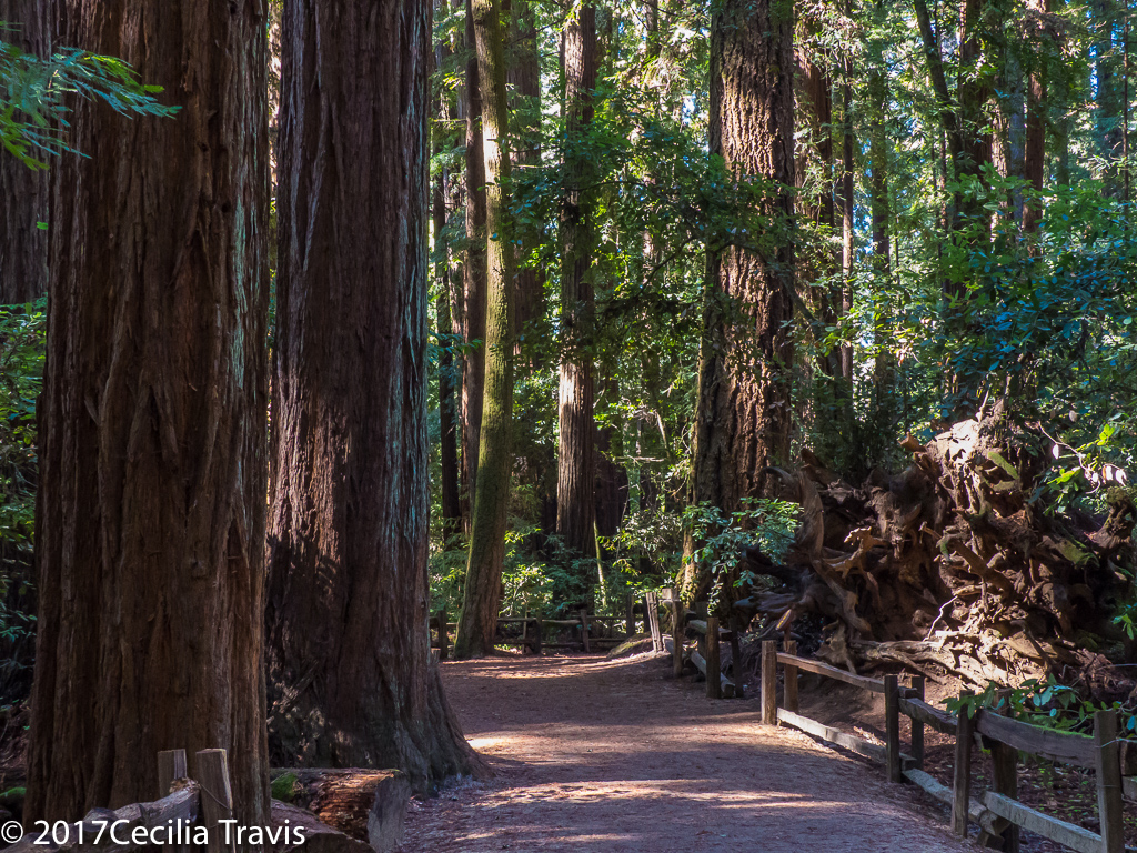
Henry Cowell Redwoods State Park, in the Santa Cruz Mountains of California has a lovely wheelchair accessible trail and an easy loop walking trail. The park is most famous for the 40-acre grove of towering old-growth redwood trees and lies on 4,650 acres of forested and open land.
The visitors center has a loaner wheelchair, but you had better call in advance (831-335-4598) as they are short staffed and sometimes the center is unpredictably closed. Here is their website. Trail descriptions
Redwood Grove Trail 0.8 mile loop – A great horned owl’s hooting added to the pleasure of this lovely trail among giant redwood trees. Thank you Mark Hehir, for the suggestion.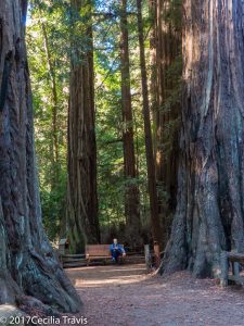
Bench on wheelchair accessible Redwood Grove Trail, Henry Cowell State Park, CA 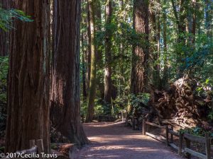
Wheelchair accessible Redwood Grove Trail, Henry Cowell State Park, CA Meadow-River Loop 1 mile loop, described as “gentle”. Take the Meadow Trail just off Highway 9 to the Nature Store and return on the River Trail.Mono Lake Tufa State Natural Reserve
Mono Lake Tufa State Natural Reserve has accessible trails and boardwalks The Reserve is 13 miles east of Yosemite National Park and is near the town of Lee Vining. 65 square mile Mono Lake is over 1 million years old, making it one of the oldest lakes in North America. It is famous for its tufa towers, calcium-carbonate spires and knobs formed by interaction of freshwater springs and alkaline lake water. The reserve protects the lake and the wetlands and other sensitive habitat for the 1 – 2 million birds that feed and rest at Mono Lake each year.
Here is their website. Information on Accessibility. Phone 760-647-6331South Tufa Interpretive Trail 0.25 mile self-guided trail to the shore and through the tufa towers. The first 0.25 mile is wheelchair accessible and the hard-packed soil beyond is easy walking.
Boardwalk Interpretive Trail 0.5 mile gives access to the north shore tufa areas and marsh.
Lake Trail 0.35 mile through the wetland to the shore.Patrick’s Point State Park
Patrick’s Point State Park has three short accessible trails. The 640 acre park is 30 miles north of Eureka, California and lies on a forested promontory overlooking the Pacific Ocean. There are accessible campsites. Patrick’s Point SP is in redwood country and you will find “Forests of spruce, hemlock, pine, fir and red alder stretch over an ocean headland with wildflower-filled meadows.” On our very short visit we just walked along the road and enjoyed the marvelous scenery. Accessibility Phone 707-677-3570 Here is the park’s website.
Ceremonial Rock/Sumeg Village Trail 0.73 goes through a spruce forest, passing near to the Native Plant Garden,Sumeg Village, and Ceremonial Rock.
Rim/Campfire Center Trail 0.87 mile is a hike along the coastal bluff with multiple views of the ocean.
Patrick’s Point Overlook Trail 0.07 a spur trail on top of coastal bluff with 180° view of the ocean.
View from easy trail at Patrick’s Point State Park, California 
Easy trail at Patrick’s Point State Park, California Point Lobos State Nature Reserve
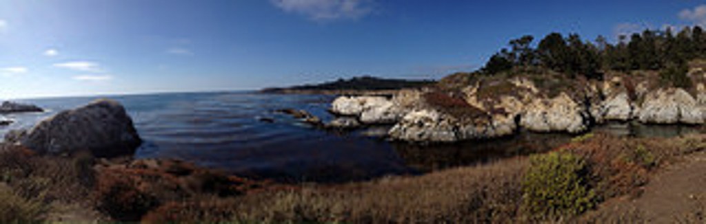
Point Lobos State Nature Reserve has five accessible trails ranging in length from 0.25 to 0.5 miles. The Reserve is remarkable for the “…rare plant communities, endangered archeological sites, unique geological formations, and incredibly rich flora and fauna of both land and sea….This area contains headlands, coves and rolling meadows.” Wildlife includes thousands of seabirds, seals, sea lions, sea otters and migrating gray whales (from December to May). Thank you to Lane Davis for letting me know about Point Lobos and for the photograph.
Phone 831-624-4909 Here is their website. Here is lots of helpful information from the Point Lobos Foundation. Accessible Features
Cypress Grove Trail 0.25 mile with views of the cove.Sand Hill Trail, 0.4 mile paved loop leading to views of the cove.Carmelo Meadow Trail 0.3 mile compacted soil “…winds through native Monterey Pine forest and terminates at Whalers Cove.”
Granite Point Trail 0.36 mile compacted soil “…hugs the Whalers Cove bluff offering spectacular views of the coastline and its abundant wildlife.”
Bird Island Trail 0.5 mile “…provides views of Bird Island and China Cove where visitors can watch harbor seals nursing new born pups.”
Point Lobos, California © Lane Davis Prairie Creek State Park
Prairie Creek Redwoods State Park …”protects sandy beaches and open meadows grazed by magnificent herds of Roosevelt elk. Ferns cascade down canyon walls. Lush stands of the world’s tallest living tree species, the coast redwood, stand in primeval majesty.” The park has three scenic drives, 75 miles of hiking trails, and a 19-mile bike loop.
Many thanks to the website visitor who brought the park to my attention, sent the photos, and wrote, “… the trail I recommend most starts near the visitor center and while the trail is not paved it is kept clear and is quite doable. When you come out at a road you can cross and go into an area where there is a very old large Redwood tree with the trail leading away from it back toward the visitor center. On this side of the road the trail is covered with fairly large broken rock which is difficult with a wheelchair. I would recommend returning on the part of the trail you were already on. Also there is at least one other accessible trail that starts near the visitor center.”
Visitor Center phone 707-488-2039 Park website. Park Brochure.
Revelation Trail 0.25 mile, designed for all five senses.Big Tree Trail 0.3 milePrairie Creek Trail 1.5 milesElk Prairie Trail 1.3 mile loop from Visitor Center
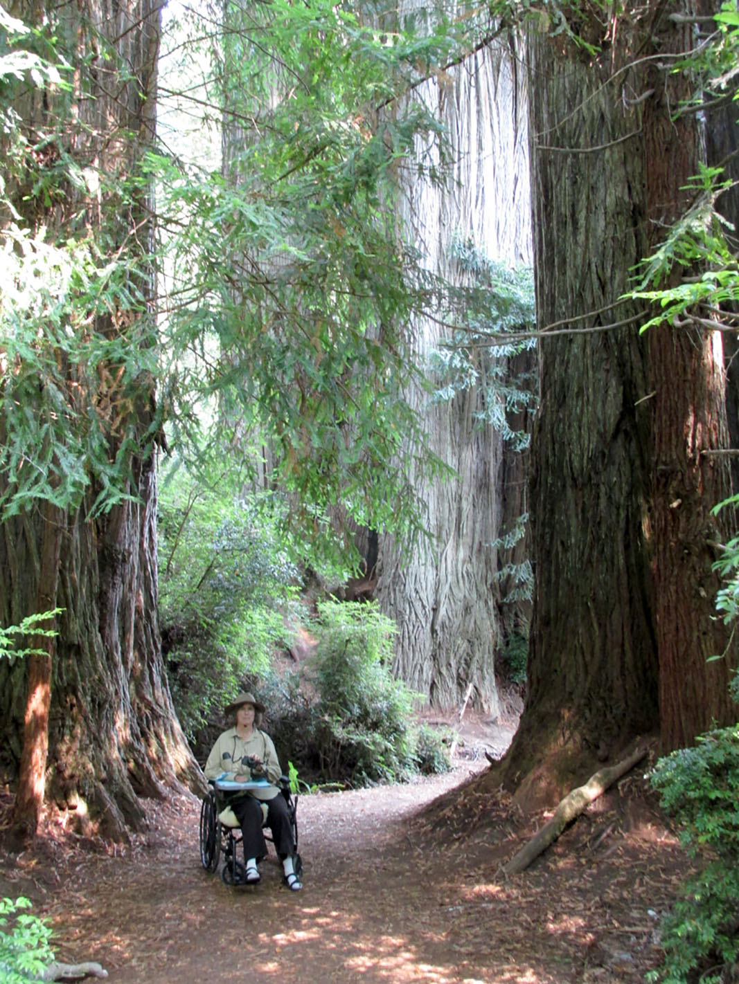
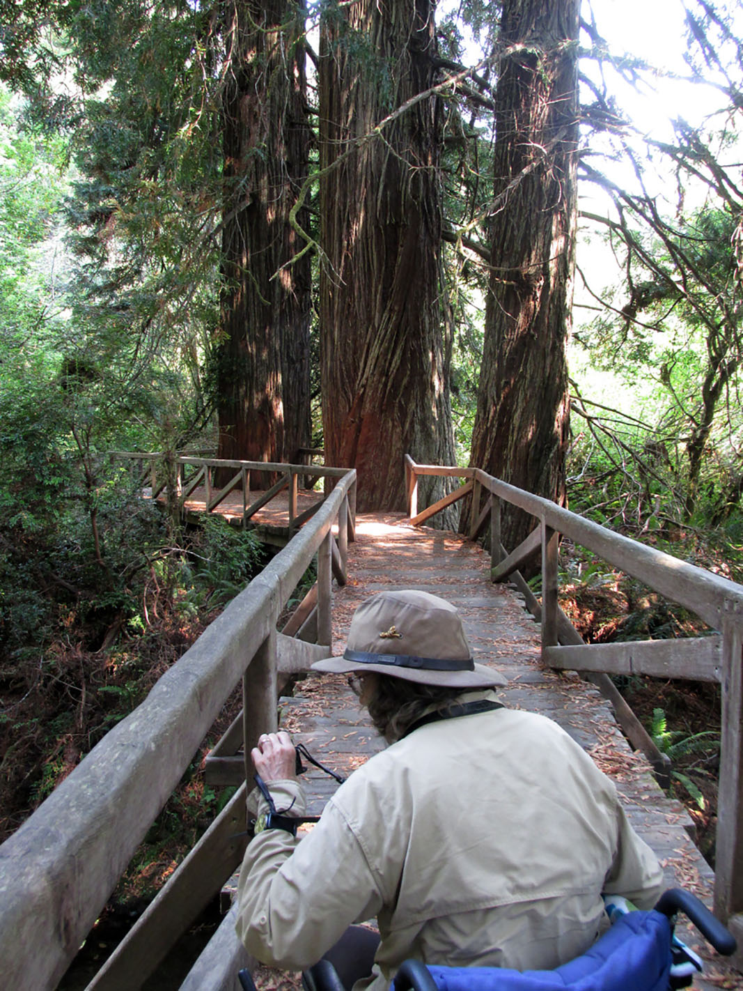
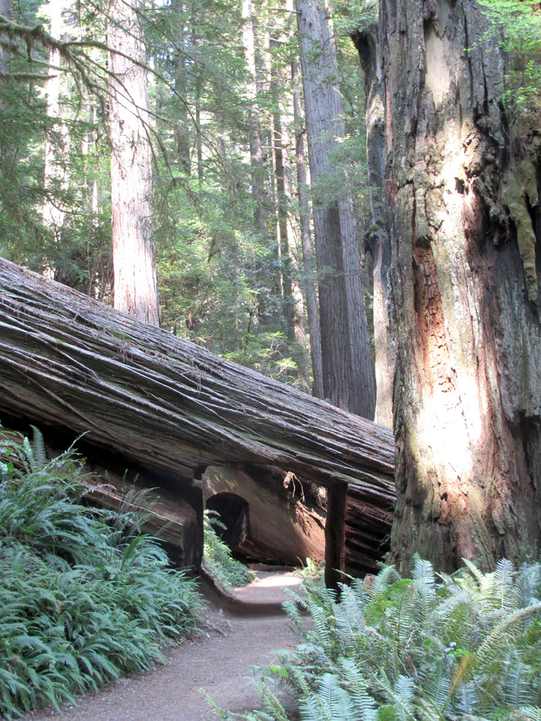
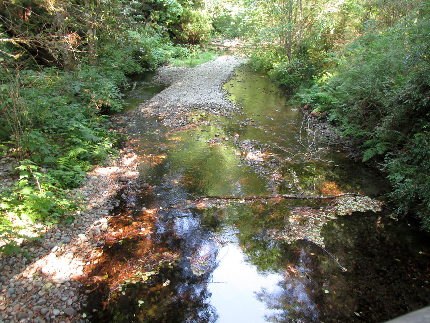
Wheelchair accessible trail Prairie Creek Redwoods State Park, CA ©Will Tait 
Wheelchair accessible boardwalk trail Prairie Creek Redwoods State Park, CA ©Will Tait 
Wheelchair accessible trail through fallen redwoods at Prairie Creek Redwoods State Park, CA ©Will Tait 
Stream by wheelchair accessible trail Prairie Creek Redwoods State Park, CA ©Will Tait Trinidad State Beach
Trinidad State Beach has a short trail through forest which is rated “generally accessible”. What we liked was that you can get to the water from the parking lot without having to go down steep stairs. The photo below was taken a short distance from the parking lot. The beach is 19 miles north of Eureka, CA, just off Highway 101. Park hours are from sunrise to sunset. Phone 707-677-3570. Here is their website. Accessibility?
 Trinidad State Beach and College Cove 2 mile loop with some steep sections. Although AllTrails describes it as suitable for all skill levels, some of their reviewer say parts are quite steep.
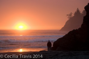
Sunset at Trinidad Beach, California

Local
Bear Yuba Land Trust
The Bear Yuba Land Trust in Nevada County, California includes at least four accessible trails in the areas where the non-profit, membership-supported organization has acquired land to conserve “the region’s natural, historical and agricultural legacy.” According to helpful people with the land trust, the trails listed below are “… ADA friendly but may not meet all ADA standards”.
Phone 520-272-5994 Here is the Trust’s Facebook page and their website Trails Portal Trails Location Map
Litton Trail 2 miles one-way. “A well-established trail through an informal urban greenbelt in the vicinity of the Sierra College campus in Grass Valley.”
Independence Trail West Independence Trail East “Independence Trail transformed an historic gold mining ditch into the nation’s first identified handicapped-accessible wilderness trail. It is now one of the most popular trails in the area, contouring along wooded hillsides, passing live streams, and crossing deep gorges on restored wooden flumes that once transported water for hydraulic mining. The trail has two separate sections — West and East — that extend from one main trailhead on Highway 49.” “West trail is wheelchair accessible in dry months from the trailhead to a short way beyond Flume 28 (about 1.1 miles one way).”
“Like the Independence Trail West, the East trail follows the gentle gradient of an old mining ditch and is wheelchair accessible. It offers occasional views of the South Yuba River canyon and passes seasonal side streams and bogs. Tree cover and a generally northerly orientation keep the trail relatively cool and green for its 1400-1500 foot elevation.”
Thank you to Rosemary Mendonca who wrote with this sad news, “…much of this wonderful trail sustained damage in the \”Jones\” wild fire last year and it is closed to the public. They intend to repair and rebuild but it\’s unknown when it will reopen. https://activenorcal.com/historic-independence-trail-destroyed-in-northern-californias-jones-fire/ https://www.bylt.org/independence-trail/“
Penn Valley Bike Trail 1.7 miles one way Not really a natural trail, the description of its environment is “commercial and residential areas with some areas of oak woodland and pines.”
Western Gateway Park Trail A small town park with lots of grassy fields and a creek running though it. The fitness trail of about a mile round trip goes through “Mixed oak woodland and pines, riparian forest, and landscaped areas.”City of Anaheim
Oak Canyon Nature Center
Oak Canyon Nature Center’s Main Road is accessible for strollers and wheelchairs. The 58-acre natural park is in the Anaheim Hills. The park consists of three adjoining canyons and there is a year-round stream. There are four miles of hiking trails which traverse one of the few remaining areas of oak woodland and coastal sage scrub in this region. There is an interpretive center, a small museum with live animals and regional natural history exhibits.
Here is Anaheim’s website and here is the website for Oak Canyon Nature Center. Phone 714-998-8380 Trail guide
Main Road 0.7 mile ” bisects the center of the canyon, offering hikers an open view. The road is level and accessible to both strollers and wheelchairs.”City of Palo Alto
“Palo Alto’s open space preserves offer a chance to hike from the marshes of the bay to the redwoods of the upper Santa Cruz mountains.”
Baylands Nature Preserve near Palo Alto – According to Wikipedia, this preserve is the “largest tract of undisturbed marshland remaining in the San Francisco Bay.” Here is Mark Hehir’s video of the accessible paths and many of the birds to be found there. Phone 650-329-2506 This is their website.
Palo Alto Open Space and ParksCity of San Jose
The city of San Jose, California has a trail system of over 57 miles of recreation and active transportation opportunities. Here is the city’s Website and their Trail Network .Alum Rock Park is about five miles from downtown San Jose. The lower trails alongside the Penitencia Creek are paved and shady. Where the pavement leaves off, there is still lovely and easy hiking as well as challenging, steep trails. The park is in a canyon in the foothills of the Diablo Mountain Range. There are many wild animals including mountain lions, bobcats, and deer. Pets are not allowed. Ranger office phone 408-259-5477.
Here is the Park’s website. Trail Map
Easy trail Alum Rock Park, San Jose, California 
Paved accessible trail Alum Rock Park, San Jose, California 
Easy trail, Alum Rock Park, San Jose, California Modoc County
The River Center in Alturas offers a wealth of programs and information about the surrounding area, including the Pit River Watershed, Modoc County and Siskiyou County in California, Lake County and Klamath County in Oregon. The center is now housed in the Modoc Historical Museum, 600 S Main St, which is wheelchair accessible. Call 530-233-4314 ext. 115 for hours and other information.
There is an easy walking path along the Pitt River, but is very soft sand and probably would be difficult for a wheelchair.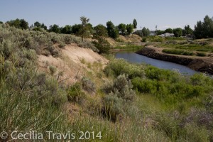
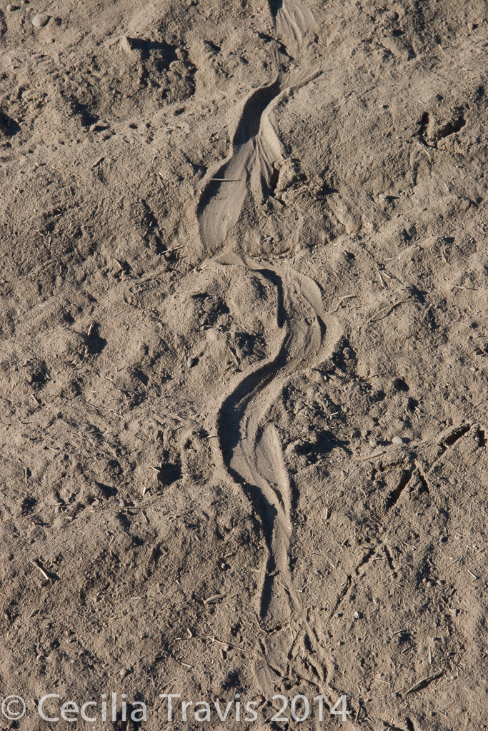
Pitt River, Alturas 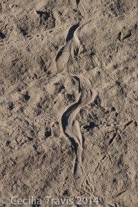
Snake and quail trails in soft sand by Pitt River Nevada City
Nevada City, California backs onto the Tahoe National Forest and has many accessible trails within or near the town. The city website lists a number of trails you can access walking from downtown or via a short drive. “The good news with all of these outings is the accessibility to the outdoors and proximity to in-town coffee shops, restaurants, wineries, pubs, art galleries and theaters.” Here is the city website’s listing of area trails. By clicking on the hiking boot by this map of Nevada County you can see all the trails in the county. Here is another map showing the location of trails in the Nevada City and Grass Valley area.Hirschman Trail “The eastern 0.4 mile of trail is constructed to ADA standards, providing barrier-free access to Hirschman’s Pond.” Map
Cascade Canal Trail 4.5 miles one way. “…an almost level walk along a peaceful canal through a forest with many Douglas firs and dogwoods. At 3200′ elevation, it is a bit higher and cooler than many local trails.” Map
Independence Trail – East and West. See Bear Yuba Trust MapSanta Clara County Parks
The regional parks system includes 28 regional parks encompassing over 52,000 acres. ” Regional parks are larger in size, usually more than 200 acres, than local neighborhood or community parks. Many of the County’s regional parks also feature points of local historic interest.” Here is their Park Finder tool for finding a park that fits your activity preference. Here is the County parks website.In response to my inquiry, they sent this helpful reply:
“We do make every effort to design and build trails that meet grade and width requirements. The following is a short list of recently constructed trails and paved pathways that offer opportunities for those with disabilities requiring the use of mobility devices.
Paved; Los Gatos Creek trail, Coyote Creek, Penitencia Creek, Martin Murphy at Coyote Lake, Harvey Bear Ranch.
Natural surface trails; Coyote Lake Harvey Bear-Campground trail, Valley Oak, Calaveras, Rancho La Polka trail via the southern segment of the Mendoza trail. Sanborn County Park-John Nicholas trail and the Indian Rock trail.”
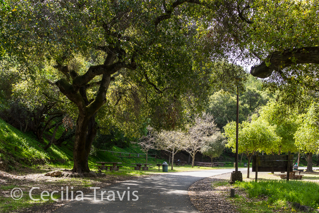
The Joseph D. Grant County Park, also known as Grant Ranch Park is in the Diablo Range foothills of the eastern Santa Clara Valley. Thank you to Mark Heir for the lovely photos. Here is a video he shot as he explored this park .
Accessible trail at Joseph Grant County Park CA © Mark Heir 
Accessible trail at Joseph Grant County Park CA © Mark Heir


Private
Miscellaneous
Erick and Elisa Mikiten’s downloadable PDF of A Wheelchair Rider’s Guide to Los Angeles and Orange County Coast
Bonnie Lewkowicz’s downloadable PDF of A Wheelchair Rider’s Guide to San Francisco Bay and the Nearby Coast
Access Northern California – This site has lots of information and they have a newsletter.
Accessible Hikes Around the Bay Area – an article by Ann Sieck
Adventures in a Wheelchair is a marvelous site with video shot by Mark, the author/photographer, from his wheelchair. He lives in the San Francisco Bay area.
The Falcon Guide “Best Easy Day Hikes Lake Tahoe” by Tracy Salcedo-Chourré is very helpful for pointing you to easy hikes.
Nature For The Blind has a directory of Braille trails for almost every state in the US and for many other countries.
Article by San Francisco Bay area Bonnie Lewkowicz : Opening the Door to Nature for People with Disabilities
- The Rails-to-Trails Conservancy – lists wheelchair accessible trails in California.
We happened on the Bizz Johnson rail trail near Susanville. What a treat! There is parking at either end of the seven mile accessible trail or you can take a wheelchair -accommodating shuttle bus from Susanville and then enjoy a 3% downhill ride along the Susan River. The bus operates from June – October on the first and third Saturdays. Call 530-252-7433 to learn more.
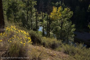
Susan River from accessible Bizz Johnson Trail 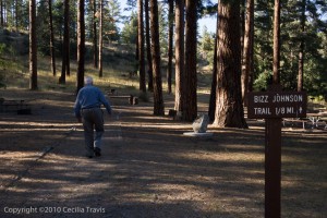
Access to the Wheelchair accessible Bizz Johnson Rail/Trail near Susanville CA Wheelchair Rider’s Guide to California Coast Here is a fantastic resource by Access Northern California and California State Coastal Conservancy. There is information for all of coastal California with searchable pages.

