Stewart B. McKinney National Wildlife Refuge
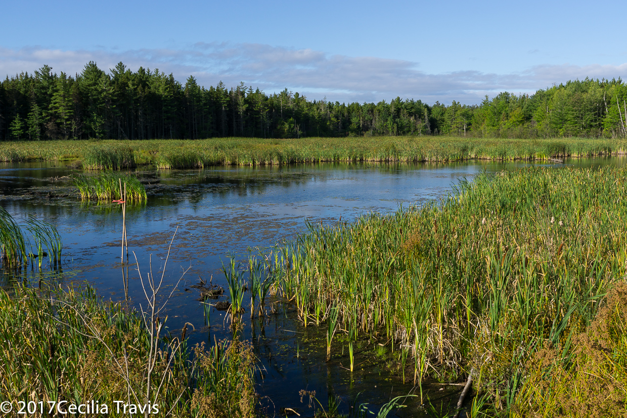
The Stewart McKinney National Wildlife Refuge is on the Atlantic Flyway and provides important habitat for many species of birds. The 10 units which stretch across 70 miles of Connecticut’s coastline encompass “over 1,000 acres of forest, barrier beach, tidal wetland and fragile island habitats.” Brochure Phone 860-399-2513 Here is their website.
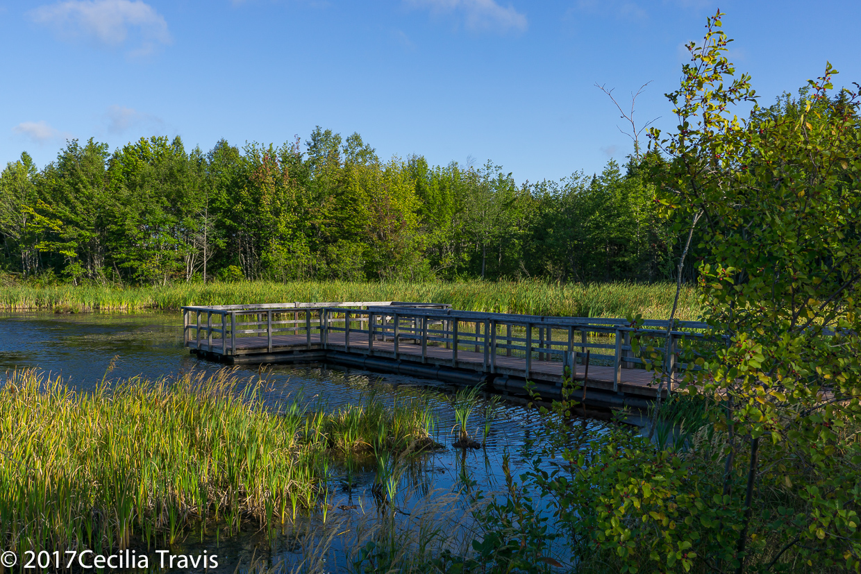
![]() The Salt Meadow Unit in Westbrook Map has a 1.1 mile loop trail described as a “pleasant stroll” on Trails.com and “good for all skill levels” on AllTrails.com.
The Salt Meadow Unit in Westbrook Map has a 1.1 mile loop trail described as a “pleasant stroll” on Trails.com and “good for all skill levels” on AllTrails.com.
Author: Cecilia
Palo Duro Canyon State Park
Palo Duro Canyon State Park
“The second largest canyon in the country lies in the heart of the Texas Panhandle.” It offers a “a myriad of recreational opportunities, rich history and colorful geology.”
Here is the Park website.Phone 806-488-2227 Trails Map Facilities Map Brochure
![]() Pioneer Nature trail 0.49 mile loop a “family-friendly trail that loops down to the river and back.”
Pioneer Nature trail 0.49 mile loop a “family-friendly trail that loops down to the river and back.”
![]() Sunflower 1.17 one way. A “shady, family-friendly trail.”
Sunflower 1.17 one way. A “shady, family-friendly trail.”
![]() Paseo del Rio 2 miles round trip “suitable for all levels”.
Paseo del Rio 2 miles round trip “suitable for all levels”.
University of New Brunswick Woodlot
University of New Brunswick Woodlot
From UNB Woodlot Watch , “The UNB Woodlot is over 3,500 acres of wild woods home to herons, blue bead lilies and lady slippers, old-growth red spruce stands, mature forest and wetlands.” Thank you Lisa Dalton, for taking me there.
![]() The map shows numerous parking spots with access to the trails. However on a visit September 2017, most of these were cordoned off and we had to park behind Costco. Map
The map shows numerous parking spots with access to the trails. However on a visit September 2017, most of these were cordoned off and we had to park behind Costco. Map
Nature Trust of New Brunswick
Nature Trust of New Brunswick The Nature Trust of New Brunswick is a “charitable land conservation organization that is responsible for conserving over 6000 acres (2400 hectares) in more than 40 beautiful and diverse nature preserves throughout the province.”
![]() Ferris Street Forest and Wetland Nature Preserve 40 acres of easy trails. The Preserve is “…home to a wide range of amphibians, insects, birds and mammals. In particular, there are many species of birds to be found in the area, including bald eagle, olive-sided flycatcher, …. and great horned owl.” “The northern edge of the preserve borders the Nashwaakis Stream which feeds into the Saint John River.”
Ferris Street Forest and Wetland Nature Preserve 40 acres of easy trails. The Preserve is “…home to a wide range of amphibians, insects, birds and mammals. In particular, there are many species of birds to be found in the area, including bald eagle, olive-sided flycatcher, …. and great horned owl.” “The northern edge of the preserve borders the Nashwaakis Stream which feeds into the Saint John River.”
Pinnacle Mountain State Park
Pinnacle Mountain State Park
Pinnacle Mountain State Park in Arkansas has two accessible trails. The park is diverse natural habitat, from the bottomlands along the Big Maumelle River and Little Maumelle River to Pinnacle Mountain which rises more than a thousand feet above the Arkansas River Valley.
![]() Kingfisher Trail 0. 5 mile The trail passes “huge 500-600 year-old baldcypress trees along the banks of the Little Maumelle River. ”
Kingfisher Trail 0. 5 mile The trail passes “huge 500-600 year-old baldcypress trees along the banks of the Little Maumelle River. ”
![]() Arkansas Trail in the Arkansas Arboretum 0.6-mile paved
Arkansas Trail in the Arkansas Arboretum 0.6-mile paved
Brochure Trails Phone 501-868-5806 Here is the park website.
Mammoth Spring State Park
Mammoth Spring State Park
Mammoth Spring State Park in northern Arkansas has the Spring Lake Trail which is said to be accessible. Mammoth Spring flows nine million gallons of water hourly, forming a scenic 10-acre lake, before flowing south as the Spring River, a popular Ozark trout and float stream.
![]() ? Spring Lake Trail meanders around the Spring Lake and across the dam. It is described as accessible on a different State website. You should call ahead to be sure.
? Spring Lake Trail meanders around the Spring Lake and across the dam. It is described as accessible on a different State website. You should call ahead to be sure.
Brochure Phone 870-625-7364 Here is the park’s website.
Lake Charles State Park
Lake Charles State Park
“Anglers and nature lovers will enjoy this peaceful park in the foothills of the Ozark Mountains on the shore of 654-acre Lake Charles.”
Here is the Park website. Brochure Trails Phone 877-879-2741
![]() Cedar Trail 1-mile loop “Most of this paved …trial follows the Lake Charles shoreline. There are several species of trees here, including sugarberry, white ash, eastern red cedar and many kinds of oaks and hickories.”
Cedar Trail 1-mile loop “Most of this paved …trial follows the Lake Charles shoreline. There are several species of trees here, including sugarberry, white ash, eastern red cedar and many kinds of oaks and hickories.”
![]() Butterflies & Blooms Trail 0.3 mile “This pleasant trail connects the campground with the visitor center. It meanders through wildflowers and wildlife habitat that changes each week through the season. Along this trail visitors often see wildlife, including birds, butterflies and deer. ”
Butterflies & Blooms Trail 0.3 mile “This pleasant trail connects the campground with the visitor center. It meanders through wildflowers and wildlife habitat that changes each week through the season. Along this trail visitors often see wildlife, including birds, butterflies and deer. ”
Hobbs State Park
Hobbs State Park
Hobbs State Park-Conservation Area (HSPCA), northeast of Springdale, Arkansas, has the accessible quarter mile Ozark Plateau Trail and half mile Historic Van Winkle Trail. The conservation area covers diverse Ozark landscape along 22 miles of the southern shore of Beaver Lake. The park has plateaus, ridges, valleys, and streams in an upland forest of oak, hickory and pine. There are many water features.
Brochure Trails Phone 479-789-5000 Here is the park’s website.
![]() Ozark Plateau Trail 0.25 mile Concrete surface inner loop and .50 of a mile crushed stone outer “challenge” loop. “Wheelchair accessible and meets ADA guidelines”
Ozark Plateau Trail 0.25 mile Concrete surface inner loop and .50 of a mile crushed stone outer “challenge” loop. “Wheelchair accessible and meets ADA guidelines”
![]() Historic Van Winkle Trail 0.5 mile
Historic Van Winkle Trail 0.5 mile
Daisy State Park
Daisy State Park
Daisy State Park is on the shore of 7,000 acre Lake Greeson in the foothills of the Ouachita Mountains in Arkansas. You will find mountain scenery and great fishing.
![]() ? Daisy Creek Trail 0.75 mile loop. The trail “highlights the different ecosystems of Daisy State Park. It begins in a heavily wooded area and meanders along Daisy Creek and Lake Greeson. The trail offers wildlife viewing opportunities including waterfowl, small mammals, owls, and other local wildlife.” In at least one State website, this trail is called “accessible”. Better call to find out.
? Daisy Creek Trail 0.75 mile loop. The trail “highlights the different ecosystems of Daisy State Park. It begins in a heavily wooded area and meanders along Daisy Creek and Lake Greeson. The trail offers wildlife viewing opportunities including waterfowl, small mammals, owls, and other local wildlife.” In at least one State website, this trail is called “accessible”. Better call to find out.
Brochure Phone 870-398-4487 Here is the park website.
Crater of Diamonds State Park
Crater of Diamonds State Park
The Crater of Diamonds State Park, Murfreesboro, Arkansas has the River Trail which is partly accessible. The purpose of this park is to “manage and interpret this unique site and to provide a meaningful diamond mining experience for all guests and future generations. ….. visitors from around the world search for diamonds in a 37-acre field which is the eroded surface of the world’s eighth largest diamond-bearing volcanic crater… Over 75,000 diamonds have been found at “The Crater.” The diamonds are white, yellow or brown. “Amethyst, garnet, jasper, agate, quartz, and more rocks and minerals may also be found at the Crater of Diamonds, making the park a rock hound’s paradise.”
![]() The River Trail 1.2 miles goes through the woods to the scenic Little Missouri River. “Half of the trail is paved and barrier-free with exhibits.”
The River Trail 1.2 miles goes through the woods to the scenic Little Missouri River. “Half of the trail is paved and barrier-free with exhibits.”
Brochure Phone 870-285-3113 Here is their website.