Crowley’s Ridge State Park
Crowley’s Ridge State Park in northeast Arkansas has an accessible trail and another considered very easy. The Park occupies the former homestead of Benjamin Crowley, whose family first settled this area. There are native log and stone structures, constructed by the Civilian Conservation Corps in the 1930s. The park has a31-acre fishing lake (electric motors only); and a 3 1/2-acre swimming lake. You can rent fishing boats, kayaks, and pedal boats. Interpretive programs are offered here throughout the year.
![]() Lake Ponder Trail 0.45 mile loop A good place to see sensitive fern and other plants that grow along the marshy shoreline.
Lake Ponder Trail 0.45 mile loop A good place to see sensitive fern and other plants that grow along the marshy shoreline.
![]() Walcott Lake Trail 0.5 mile The trail runs along the top of the fishing lake levee and is good for spotting water birds
Walcott Lake Trail 0.5 mile The trail runs along the top of the fishing lake levee and is good for spotting water birds
Brochure Trail Guide Phone 870-573-6751 Here is the park website.
Author: Cecilia
Arkansas State Parks – Easy Trails
Cossatot River State Park-Natural Area
Cossatot River State Park-Natural Area
Cossatot River State Park in southwest Arkansas south of Mena has two interpretive trails, one of them accessible. The Park lies along 12 miles of the Cossatot River, a premier whitewater float stream. The Cossatot is a National Wild and Scenic River and flows through the rugged canyon of Cossatot Falls. Here is their website. Brochure Phone 870-385-2201
![]() ? Brushy Creek Interpretive Trail 0.75 mile “through mixed – southern forest cover, and offers a scenic view overlooking the Cossatot River/Brushy Creek union.” Tree Guide This trail is described as “barrier-free”, but I see there is a “flight of stairs” down to the parking lot at the end. Better call ahead to learn more.
? Brushy Creek Interpretive Trail 0.75 mile “through mixed – southern forest cover, and offers a scenic view overlooking the Cossatot River/Brushy Creek union.” Tree Guide This trail is described as “barrier-free”, but I see there is a “flight of stairs” down to the parking lot at the end. Better call ahead to learn more.
![]() Waterleaf Interpretive Trail ” … begins at the visitor center and includes a section of barrier-free trail along the ridge top.”
Waterleaf Interpretive Trail ” … begins at the visitor center and includes a section of barrier-free trail along the ridge top.”
Know more about Cossatot River State Park?
Have you visited this location and know of more accessible or easy trails? Is any of the information given here incorrect? If so, please contact me using the form to the left and let me know what should be changed or added so I can update this post.
Bull-Shoals State Park
Bull – Shoals State Park
Bull Shoals-White River State Park, in the Ozark mountains of north central Arkansas, northwest of Mountain home, has an accessible paved loop trail. The park lies along the riverside and lakeshore where the White River and Bull Shoals Lake join at the Bull Shoals Dam. The area is known for fishing and boating opportunities.
Trails Guide Brochure Phone 501-682-1191 Here is their website.
![]() Gaston Wildflower Garden Area and Trail 0.75 mile paved loop
Gaston Wildflower Garden Area and Trail 0.75 mile paved loop
![]() Lakeside Trail 1 mile. Rated easy, but check first to see if it is suitable for you.
Lakeside Trail 1 mile. Rated easy, but check first to see if it is suitable for you.
Know more about Bull Shoals State Park?
Have you visited this location and know of more accessible or easy trails? Is any of the information given here incorrect? If so, please contact me using the form to the left and let me know what should be changed or added so I can update this post.
City of San Jose
City of San Jose
The city of San Jose, California has a trail system of over 57 miles of recreation and active transportation opportunities. Here is the city’s Website and their Trail Network .
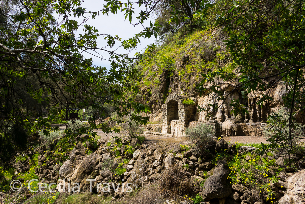
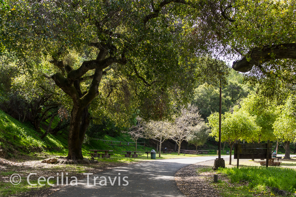
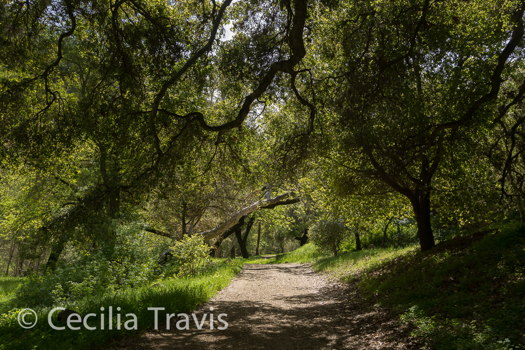
![]() Alum Rock Park is about five miles from downtown San Jose. The lower trails alongside the Penitencia Creek are paved and shady. Where the pavement leaves off, there is still lovely and easy hiking as well as challenging, steep trails. The park is in a canyon in the foothills of the Diablo Mountain Range. There are many wild animals including mountain lions, bobcats, and deer. Pets are not allowed. Ranger office phone 408-259-5477.
Alum Rock Park is about five miles from downtown San Jose. The lower trails alongside the Penitencia Creek are paved and shady. Where the pavement leaves off, there is still lovely and easy hiking as well as challenging, steep trails. The park is in a canyon in the foothills of the Diablo Mountain Range. There are many wild animals including mountain lions, bobcats, and deer. Pets are not allowed. Ranger office phone 408-259-5477.
Here is the Park’s website. Trail Map
Point Bridget State Park
Point Bridget State Park
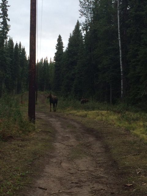
The 2,850 acre Point Bridget State Park is forty miles north of Juneau and has muskeg, meadows, cliffs, salmon spawning streams, and rocky beaches on the sea. Point Bridget Trail is said to be easy.
![]() Point Bridget Trail 3.5 miles one way. Description from Alaska.org: The trail “meanders through muskeg, mature forest, and grassland until it reaches a beaver dam and views of the Lynn Canal. Bears often visit the meadow, but leave it to fish the stream. In spring, thousands of white-winged and surf scooters swim wing to wing in one giant raft. It is quite a sight to behold. Sea lions and harbor seals are often seen near shore and every once-in-awhile a humpback whale is offshore.”
Point Bridget Trail 3.5 miles one way. Description from Alaska.org: The trail “meanders through muskeg, mature forest, and grassland until it reaches a beaver dam and views of the Lynn Canal. Bears often visit the meadow, but leave it to fish the stream. In spring, thousands of white-winged and surf scooters swim wing to wing in one giant raft. It is quite a sight to behold. Sea lions and harbor seals are often seen near shore and every once-in-awhile a humpback whale is offshore.”
At 7 miles round trip with an elevation gain of over 400′ this trail is likely to be too long and have too much elevation gain for you to do the entire trail, although it is described as suitable for all skill levels and “kid friendly”. The wildflowers and scenery may make it worthwhile walking part way. Here is the park website and a description of Trails in Point Bridget State Park Park Map Park Guide
Phone 907-465-4563
Mendenhall Wetlands – State Game Refuge
Mendenhall Wetlands – State Game Refuge easy, accessible trails
Mendenhall Wetlands State Game Refuge at Juneau, Alaska has some accessible trails. The refuge is a saltwater wetlands which provides a vital feeding and resting area for both resident birds and migrants traveling to and from their Arctic breeding grounds. The 4,000-acre wildlife refuge stretches nine miles along the shores of Gastineau Channel and is enjoyed for waterfowl hunting, hiking, wildlife viewing and photography, boating, fishing, and scientific and educational studies. Here is their website. Phone 907-465-4266 A fuller description of these trails is found on Alaska.org’s Juneau Hiking Trails.
![]() Airport Dike Trail 1.2 miles paved. Elevation gain 3′. “It has many opportunities for waterfowl and bird watching.”
Airport Dike Trail 1.2 miles paved. Elevation gain 3′. “It has many opportunities for waterfowl and bird watching.”
![]() Mendenhall Wetlands Trail 1 mile “…runs through the wetlands between the mainland and Douglas Island. It’s a great walk for families, birdwatchers, and exercisers. There are interpretive signs along the trail, with information about the birds, animals, and the wetlands ecosystems. “
Mendenhall Wetlands Trail 1 mile “…runs through the wetlands between the mainland and Douglas Island. It’s a great walk for families, birdwatchers, and exercisers. There are interpretive signs along the trail, with information about the birds, animals, and the wetlands ecosystems. “
City of Juneau
City of Juneau – accessible, easy trails
The Juneau area does have a few easy accessible trails, in spite of the vertical nature of its setting. Parks and Recreation’s phone number is 907-459-1070. Here is their website. Alaska.org’s Juneau Hiking Trails has good descriptions of the nearby trails.
![]() Mendenhall River Trail 2 miles, paved. The trail follows the Mendenhall River greenbelt area, starting at Brotherhood Bridge. “In mid-summer, over a flat field of iris and fireweed, the Mendenhall rises between McGinnis Mountain and the Sawtooth Peaks.”
Mendenhall River Trail 2 miles, paved. The trail follows the Mendenhall River greenbelt area, starting at Brotherhood Bridge. “In mid-summer, over a flat field of iris and fireweed, the Mendenhall rises between McGinnis Mountain and the Sawtooth Peaks.”
![]() Rainforest Trail 0.5 mile trail leading out to the north end of Douglas Island. There is a small beach there with beautiful views.
Rainforest Trail 0.5 mile trail leading out to the north end of Douglas Island. There is a small beach there with beautiful views.
University of Alaska Fairbanks Trail System
University of Alaska Fairbanks Trail System
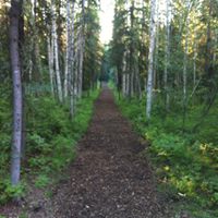
![]() The university maintains an in-town trail network. “North Campus consists of approximately 1,100 acres of largely forested land on the north-to-northwest side of campus. ” Thank you, Kara Axx, North Campus Manager, for writing”…our trails are not officially up to the ADA standard for wheelchair accessibility. That being said, most of the trails on the UAF network would be considered on the easier side. Our Viereck Nature trail is actually in a steeper area of our trail system, but a senior in relevantly good shape should be fine completing. It is about a 1K – 2K loop of fairly level natural surface with minimal tripping hazards. There are signs identifying plant species, so it is like a self guided nature walk. Here is the website for the Trail System.
The university maintains an in-town trail network. “North Campus consists of approximately 1,100 acres of largely forested land on the north-to-northwest side of campus. ” Thank you, Kara Axx, North Campus Manager, for writing”…our trails are not officially up to the ADA standard for wheelchair accessibility. That being said, most of the trails on the UAF network would be considered on the easier side. Our Viereck Nature trail is actually in a steeper area of our trail system, but a senior in relevantly good shape should be fine completing. It is about a 1K – 2K loop of fairly level natural surface with minimal tripping hazards. There are signs identifying plant species, so it is like a self guided nature walk. Here is the website for the Trail System.
“Other areas that might be more friendly would be Ballaine Lake (east side of campus) because there is easy access via a state maintained wayside with ample parking and a picnic area. There are several trail connections, so trips can be very short to loops, to mid range. The trails are all relatively flat in that area with a level surface and minimal tripping hazards. One thing to highlight for our trail system is that they are open for walking with or without dogs, wildlife viewing and bird watching (even rainbow trout fishing at Ballaine lake) during the summer months, but in the winter almost all of the trails become a network of groomed ski trails that are closed to walking and dogs. ”
Map Phone 907-474-2648 Facebook
Tongass National Forest
Tongass National Forest
Tongass National Forest has accessible and easy trails. It is the nation’s largest national forest. It covers most of Southeast Alaska, including the Inside Passage, Mendenhall Glacier, Bear Creek, and Admiralty Island. This national forest “is the largest intact temperate rainforest in the world, and is home to a majestic array of islands, mountains, forests, glaciers, salmon streams, fjords and bays.” From TravelAlaska.com
![]() Ward Creek Trail 1.4 miles gravel surfaced in rolling terrain.
Ward Creek Trail 1.4 miles gravel surfaced in rolling terrain.
![]() Pipeline Trail 3.1 miles gravel surface in rolling terrain.
Pipeline Trail 3.1 miles gravel surface in rolling terrain.
![]() Mosquito Cove Trail 1.5 mile loop through hemlock/spruce forest. The first 1000′ is ADA complaint.
Mosquito Cove Trail 1.5 mile loop through hemlock/spruce forest. The first 1000′ is ADA complaint.
![]() Eagle’s Nest Campground Interpretive Trail 0.5 mile through spruce trees, along Control Creek where salmon spawn.
Eagle’s Nest Campground Interpretive Trail 0.5 mile through spruce trees, along Control Creek where salmon spawn.
![]() Wukuklook Beach Trail 0.5 mile boardwalk to Wukuklook Beach.
Wukuklook Beach Trail 0.5 mile boardwalk to Wukuklook Beach.
![]() Crystal Lake Trail 0.8 mile on natural glacier gravel deposits. This trail is rated “easy”, but may not be easy enough. Call the Forest to learn more.
Crystal Lake Trail 0.8 mile on natural glacier gravel deposits. This trail is rated “easy”, but may not be easy enough. Call the Forest to learn more.
![]() Lake Florence Trail 1.4 miles “The trail gradually climbs from saltwater on Chatham Strait through a spruce/hemlock forest and ends at Lake Florence.” Rated easy, but check first.
Lake Florence Trail 1.4 miles “The trail gradually climbs from saltwater on Chatham Strait through a spruce/hemlock forest and ends at Lake Florence.” Rated easy, but check first.
Tongas National Forest Headquarters 907-225-3101 website Map
The Forest Service has produced this guide to Trails outside Ketchikan. It includes trails within the Forest and some administered by the City of Ketchikan. A number of these sound pretty easy, although not wheelchair accessible. Call the Ranger District to learn more. 907-225-2148
Know more about Tongas National Forest ?
Have you visited this location and know of more accessible or easy trails? Is any of the information given here incorrect? If so, please contact me using the form to the left and let me know what should be changed or added so I can update this post.