Kasha-Katuwe Tent Rocks National Monument
Here is the Monument website. Phone 505-331-6259 Be sure to call ahead to be sure of trail conditions. Here is a nice description from newmexiconomad.
![]() “The Cave Loop Trail is 1.2 miles long, rated as easy and portions are ADA accessible” It is not clear as to what portions so do call ahead. Reviews on Trip Advisor.
“The Cave Loop Trail is 1.2 miles long, rated as easy and portions are ADA accessible” It is not clear as to what portions so do call ahead. Reviews on Trip Advisor.
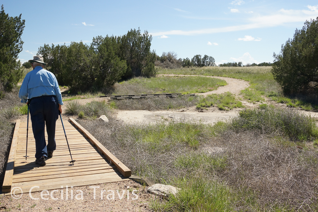
![]() “The Veterans Memorial Trail is a 1-mile long loop trail, rated as very easy and is wheel chair accessible. The Veterans Memorial is located at the end of a 3 mile long gravel surfaced road overlooking picturesque Peralta Canyon and Jemez Mountain peaks. “
“The Veterans Memorial Trail is a 1-mile long loop trail, rated as very easy and is wheel chair accessible. The Veterans Memorial is located at the end of a 3 mile long gravel surfaced road overlooking picturesque Peralta Canyon and Jemez Mountain peaks. “
Author: Cecilia
El Malpais National Conservation Area
El Malpais National Conservation Area
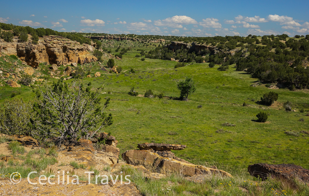
“The richly diverse volcanic landscape of El Malpais offers solitude, recreation, and discovery. Explore cinder cones, lava tube caves, sandstone bluffs, and hiking trails. Wildlife abounds in the open grasslands and forests. ”
Here is the Area website from the BLM. Here is another from the National Park Service. Map Call the BLM at 505-287-7911 or the Northwest New Mexico Visitor Center 505-876-2783 for information about the trails. I am not sure how easy the footing is on them.
![]() ? The 1/2 mile round trip hike to La Ventana Natural Arch is described as “relatively easy”.
? The 1/2 mile round trip hike to La Ventana Natural Arch is described as “relatively easy”.
![]() ? The Ranger Station Nature Trail is a 1 1/4 mile loop with an elevation gain of 125 feet.
? The Ranger Station Nature Trail is a 1 1/4 mile loop with an elevation gain of 125 feet.
Accessible Nature Travel.com in NM
Good coverage of accessible natural areas in New Mexico: AccessibleNatureTravel.com
-Accessible Features in New Mexico State Parks
Accessible Features in New Mexico State Parks
The following parks are listed as having accessible trails:
Bottomless Lakes, Devil’s Inkwell Campground Trail
Cerrillos Hills, Village View Trail
Eagle Nest Lake, Visitor Center picnic area trail
Elephant Butte Lake, West Lake Shore Trail from Monticello Campground
Leasburg Dam, Riverside Trail
Living Desert Zoo & Gardens, Zoo Trails
Mesilla Valley Bosque, Overlook & Demonstration Garden Trails
Rio Grande Nature Center, Aldo Leopold & Paseo del Bosque Trails
Sugarite Canyon, Chicorica Boardwalk Trail
Los Alamos County
Los Alamos County
Open Space and Trails The County Trail Network with links to trail descriptions.
Los Alamos Nature Center opened May, 2015 and has rave reviews on Trip Advisor. The Pajarito Environmental Education Center operates from here and has an intriguing program called “Gentle Walks”. Give them a call 505-662-0460 see if any of these walks are within your capabilities. The Los Alamos Trails App can be downloaded on Apple products, and will soon be available for Android, as well.
![]() Katherine Watson, executive director, writes that “…the only really accessible trail in Los Alamos is the paved Canyon Rim Trail. ” Clifton Russell also mentioned this trail: “In Los Alamos County, but not on the Forest, there is a very nice paved trail as you go into Los Alamos called the Canyon Rim trail. It is about 2 miles long and goes along the south side of the highway by the Airport. Lovely views over the canyon, wide, mostly level. A visitor would see the signs by the airport runway as they drive into town.”
Katherine Watson, executive director, writes that “…the only really accessible trail in Los Alamos is the paved Canyon Rim Trail. ” Clifton Russell also mentioned this trail: “In Los Alamos County, but not on the Forest, there is a very nice paved trail as you go into Los Alamos called the Canyon Rim trail. It is about 2 miles long and goes along the south side of the highway by the Airport. Lovely views over the canyon, wide, mostly level. A visitor would see the signs by the airport runway as they drive into town.”
![]() The North Bayo Bench Trail is a historic road ending at a viewpoint overlooking the orange-walled Bayo Canyon. 3.2 miles
The North Bayo Bench Trail is a historic road ending at a viewpoint overlooking the orange-walled Bayo Canyon. 3.2 miles
Duke Farms
Duke Farms
Here is their website. Interactive Map Map layer of accessible trails Trip Advisor Reviews
![]() Duke Farms is “located on 2,740 acres in Hillsborough, Somerset County, N.J.” There are “18 miles of paved, gravel, wood-chipped and mown-grass trails and pathways through a variety of habitats.” James Hanson, their helpful manager of digital media and GIS, wrote that “The only place with a moderate slope is around the Old Foundation, otherwise all the paved roads and paths are relatively flat. The Farm Barn Orientation Center and Orchid Range both contain automatic push-button doors and handicap restrooms.”
Duke Farms is “located on 2,740 acres in Hillsborough, Somerset County, N.J.” There are “18 miles of paved, gravel, wood-chipped and mown-grass trails and pathways through a variety of habitats.” James Hanson, their helpful manager of digital media and GIS, wrote that “The only place with a moderate slope is around the Old Foundation, otherwise all the paved roads and paths are relatively flat. The Farm Barn Orientation Center and Orchid Range both contain automatic push-button doors and handicap restrooms.”
Comanche National Grasslands -Vogel Canyon
Comanche National Grasslands – Vogel Canyon
Vogel Canyon, a tributary of the Purgatorie River Drainage, has the easy Overlook trail and three other hiking trails going to the canyon bottom or along the mesa top. There are two permanent springs located at the bottom of the canyon, which support a variety of wildlife. American Indians lived in the canyon 300 – 800 years ago and left rock art which is visible on the canyon walls.
Here is the Forest Service Website and another website with lots of information.
![]() “The Overlook Trail is a one mile round trip. This trail is handicapped accessible and consists of a gravel walkway along the top of canyon.” the trail goes through shortgrass prairie and juniper trees and ends at the top of a small cliff with a view of the canyon. Here is a trail description from All Trails.
“The Overlook Trail is a one mile round trip. This trail is handicapped accessible and consists of a gravel walkway along the top of canyon.” the trail goes through shortgrass prairie and juniper trees and ends at the top of a small cliff with a view of the canyon. Here is a trail description from All Trails.
Delaware & Raritan Canal State Park
Delaware & Raritan Canal State Park
“The Delaware and Raritan Canal State Park is one of central New Jersey’s most popular recreational corridors for canoeing, jogging, hiking, bicycling, fishing and horseback riding. The canal and towpath are part of the National Recreational Trail System. The 70-mile linear park is a valuable wildlife corridor connecting fields and forests.”
Here is the Park website. 609-924-5705 Map
![]() “Both the Main Canal Trail, which runs 34 miles in length, and the Feeder Canal Trail at 31.5 miles are ADA accessible.”
“Both the Main Canal Trail, which runs 34 miles in length, and the Feeder Canal Trail at 31.5 miles are ADA accessible.”
Cape May Point State Park
Cape May Point State Park
The park’s 244 acres on the southern tip of New Jersey has “…constantly changing shoreline, dunes, freshwater coastal marsh and ponds, forested islands and varied uplands.”
Here is the Park website. Phone 609-884-2159
![]() Red Trail “is .5 miles, and is wheel chair accessible. This trail offers hikers access to both the lighthouse pond west and east. Each pond has a blind or platform at the water’s edge to view wading birds, ducks, swans, as well as the occasional osprey…..”
Red Trail “is .5 miles, and is wheel chair accessible. This trail offers hikers access to both the lighthouse pond west and east. Each pond has a blind or platform at the water’s edge to view wading birds, ducks, swans, as well as the occasional osprey…..”
![]() There are two other easy, short trails – the 1.5 mile Yellow Trail and 2.0 mile Blue trail. You may need to step up to and down from boardwalks, but I was told by the attendant at the visitor’s center that they are in no way strenuous.
There are two other easy, short trails – the 1.5 mile Yellow Trail and 2.0 mile Blue trail. You may need to step up to and down from boardwalks, but I was told by the attendant at the visitor’s center that they are in no way strenuous.
Short Hikes in New Jersey
Short Hikes in New Jersey. Here is a nice site describing “Trail maps, photos, videos, and info for some trails in New Jersey that are easy or short. These trails are either under 4 miles and/or easy – suitable for beginning hikers or anyone looking for an easy day hike.”