Brendan T. Byrne State Forest
“…hikers can follow the sandy trails and roads that crisscross the forest, sometimes passing near the remains of stone or brick structures or where large depressions indicate the location of what was once a bustling town. Pure, iron-rich streams flow through acres of swampy land covered with dense stands of Atlantic white cedar.” The park used to be called Lebanon State Forest.
Here is the Forest website. Trail Map Contact: 609-726-1191
![]() Cranberry Trail 1.1 mile loop. The blog South Jersey Trails has some images of it.
Cranberry Trail 1.1 mile loop. The blog South Jersey Trails has some images of it.
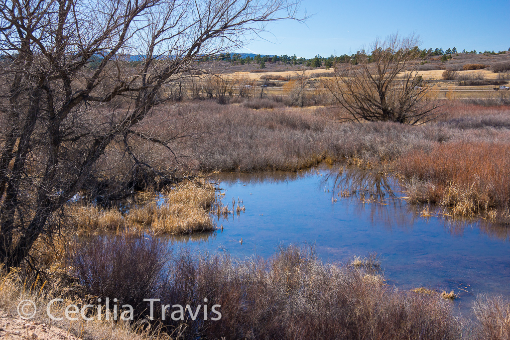
![]() The sandy, pine needle-covered trails to Pakim Pond and Mt. Misery appear to be quite easy, although maybe longer than you would want to complete. They are described in nj hiking.
The sandy, pine needle-covered trails to Pakim Pond and Mt. Misery appear to be quite easy, although maybe longer than you would want to complete. They are described in nj hiking.
Author: Cecilia
Pocket Ranger Apps – Multiple States
Pocket Ranger Apps. These free apps for mobile devices are guides to many (about 30) of the States’ parks, forests and historic places, as well as to many National Parks. Their usefulness varies between states. Their GPS information might be nice to have in the field, but for general information about the trails, the individual state parks’ websites are easier to use.
Hiking New Jersey Trail Finder
Hiking New Jersey Trails Finder This is a comprehensive website with information about and links to many hiking trails in New Jersey. Lengths, ease, and GPS coordinates are given and the links take you to detailed descriptions.
Albuquerque
Albuquerque
![]() Paseo del Bosque Trail 16 miles of paved trail from the “north to the south edges of the metro area through the Rio Grande’s cottonwood bosque (forest).” The trail passes through Rio Grande Valley State Park. Photographic tour Printable map
Paseo del Bosque Trail 16 miles of paved trail from the “north to the south edges of the metro area through the Rio Grande’s cottonwood bosque (forest).” The trail passes through Rio Grande Valley State Park. Photographic tour Printable map
Truckee Meadows Trails Guide
The Truckee Meadows Trails Guide 2016 is the source for many of my posts. The guide is about public trails around the Truckee Meadows and is a cooperative effort by Reno, Sparks and Washoe County. The link will take you to the top and you need to scroll down the the given page number.
Sparks
Sparks
There are 40+ parks in the Sparks area.
Here is Sparks’ website. Phone (775) 353-2376
![]() Vista-Campello Loop Trail The 3 mile concrete loop “offers a look at a variety of trees, shrubs and native plants. Many birds, cottontail rabbits and even an occasional coyote call this trail home.”
Vista-Campello Loop Trail The 3 mile concrete loop “offers a look at a variety of trees, shrubs and native plants. Many birds, cottontail rabbits and even an occasional coyote call this trail home.”
Washoe County
Washoe County
Parks and Open Space call (775) 823-6500 website
The following trails were found in the Truckee Meadows Field Guide.
![]() Rah Rah Interpretive Trail page 38. This paved, half-mile “interpretive nature loop trail inside Golden Eagle Regional Park highlights the Native American and natural history of the Rah Rah range.”
Rah Rah Interpretive Trail page 38. This paved, half-mile “interpretive nature loop trail inside Golden Eagle Regional Park highlights the Native American and natural history of the Rah Rah range.”
![]() Swan Lake Nature Study Area page 50 ..”features an unusually diverse population of birds, including swans. Boardwalks take visitors throughout the wetlands area. Hiking trails also are available to the lake shore.”
Swan Lake Nature Study Area page 50 ..”features an unusually diverse population of birds, including swans. Boardwalks take visitors throughout the wetlands area. Hiking trails also are available to the lake shore.”
Washoe Lake State Park
Washoe Lake State Park
Situated between Reno and Carson City, Washoe Lake State Park sits in a valley with views of the Sierra Nevada, Carson and Virginia mountain ranges. The park “…hosts a diverse range of birds and waterfowl, such as American white pelicans and Canada geese. Anglers can aim for channel and bullhead catfish, wipers, white bass and Sacramento Perch.”
Here is the Park website. Trail Map
![]() The park has a number of mostly low-gradient sandy trails with short steeper stretches. Call (775) 687-4319 to learn more.
The park has a number of mostly low-gradient sandy trails with short steeper stretches. Call (775) 687-4319 to learn more.
![]() Equestrian Trails Page 35 of this Truckee Meadows area guide states that the 15 miles of equestrian trails north of the paved bike path are ADA accessible. I don’t see these trails on the park trail map.
Equestrian Trails Page 35 of this Truckee Meadows area guide states that the 15 miles of equestrian trails north of the paved bike path are ADA accessible. I don’t see these trails on the park trail map.
![]() Paved Bike Path runs 2.7 miles on asphalt and is 8 feet wide. It is not shown as wheelchair accessible in the park literature, so you had better check first. 775-687-4319.
Paved Bike Path runs 2.7 miles on asphalt and is 8 feet wide. It is not shown as wheelchair accessible in the park literature, so you had better check first. 775-687-4319.
Reno
Reno Parks and Recreation call 775-334-2262.
![]() Huffaker Park Lookout Trail page 30. This compacted gravel trail in Huffaker Park “wraps around a pair of hills offering a view of the Truckee Meadows. Visitors can hike a .75-mile or a 1.6-mile loop….”
Huffaker Park Lookout Trail page 30. This compacted gravel trail in Huffaker Park “wraps around a pair of hills offering a view of the Truckee Meadows. Visitors can hike a .75-mile or a 1.6-mile loop….”
![]() Oxbow Nature Study Area Trail page 56 “From the trail inside Oxbow Nature Study Area, visitors may see deer, wild rabbits, beaver, golden eagles, hawks, falcons, quail, several types of ducks, snakes, lizards, muskrats and other native species. The trail has multiple access points to the Truckee River.”
Oxbow Nature Study Area Trail page 56 “From the trail inside Oxbow Nature Study Area, visitors may see deer, wild rabbits, beaver, golden eagles, hawks, falcons, quail, several types of ducks, snakes, lizards, muskrats and other native species. The trail has multiple access points to the Truckee River.”
![]() Virginia Lake Loop Trail page 34. A one mile loop around the lake.
Virginia Lake Loop Trail page 34. A one mile loop around the lake.
Douglas County Open Space
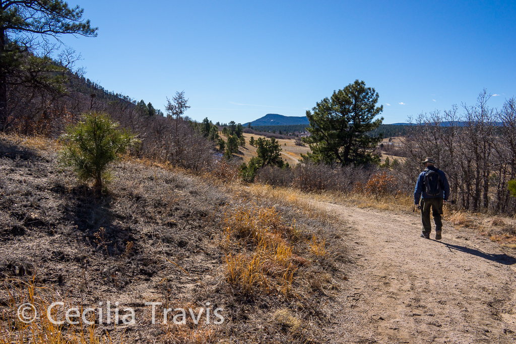
![]() Columbine Open Space and Trail There are two 1.2 mile loops and the walking is pretty easy, but erosion makes the crusher fine trails doubtful for wheelchairs. The trails are close to traffic noise from I25.
Columbine Open Space and Trail There are two 1.2 mile loops and the walking is pretty easy, but erosion makes the crusher fine trails doubtful for wheelchairs. The trails are close to traffic noise from I25.