Dr. Edmund A. Babler Memorial State Park
Just minutes from St. Louis, Babler Memorial State Park offeres hiking and equestrian trails that “…wind their way through the park’s narrow coves, deep sheltered valleys and towering forests.”
Phone (636) 458-3813 Map Here is the Park website.
From the Accessibility Information page:
![]() ? “Two miles of trail are paved, however, the trail contains slopes that may be prohibitive to some users.”
? “Two miles of trail are paved, however, the trail contains slopes that may be prohibitive to some users.”
Author: Cecilia
-Missouri State Parks
All Missouri State Parks can be found on their searchable webpage. You can plug in amenities you wish to find. Each state park’s website has a link to a pdf page of Accessibility Information.
Accessibility Information for Missouri Parks and Historic sites.
Big Oak Tree State Park
Big Oak Tree State Park
Big Oak Tree State Park preserves forest and marsh as the first explorers saw it. “Towering hickory trees and oaks form a canopy that averages more than 120 feet in height…” “The trees and wetlands make the park a prime place for wildlife. ”
Here is the Park website. Phone 573-649-3149 Map Trail Map
![]() There is a self-guided boardwalk 0.7 mile one way. Its surface is good traction for wheel chairs, but makes use of a cane a little wobbly.
There is a self-guided boardwalk 0.7 mile one way. Its surface is good traction for wheel chairs, but makes use of a cane a little wobbly.
![]() Bottomland Trail is a 1 1/2 mile loop. Its dirt surface is all right for wheelchairs in dry times, but not when wet.
Bottomland Trail is a 1 1/2 mile loop. Its dirt surface is all right for wheelchairs in dry times, but not when wet.
![]() Cypress Trail is a 0.75 mile loop. Like Bottomland Trail, it is only good for wheelchairs when dry.
Cypress Trail is a 0.75 mile loop. Like Bottomland Trail, it is only good for wheelchairs when dry.
Rock Bridge Memorial State Park
Rock Bridge Memorial State Park
Rock Bridge Memorial State Park, near Columbia, “…contains a wide diversity of natural and cultural resources to explore. Some of Missouri’s finest examples of karst topography, restored grasslands, forests and streams rest within park boundaries.”
Here is the Park website. Phone 573-449-7402 Map Trail Map
From the Accessibility Information Page:
![]() “The portion of the Springbrook trail, in the sidebar of the Devil’s Icebox kiosk up to the bridge, is accessible over natural turf. Devil’s Icebox trail is partially accessible from trailhead to the rock bridge.”
“The portion of the Springbrook trail, in the sidebar of the Devil’s Icebox kiosk up to the bridge, is accessible over natural turf. Devil’s Icebox trail is partially accessible from trailhead to the rock bridge.”
Two Ponds National Wildlife Refuge
Two Ponds National Wildlife Refuge
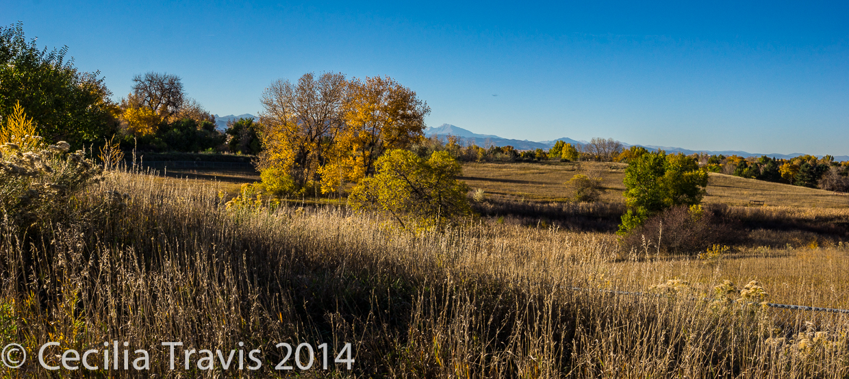
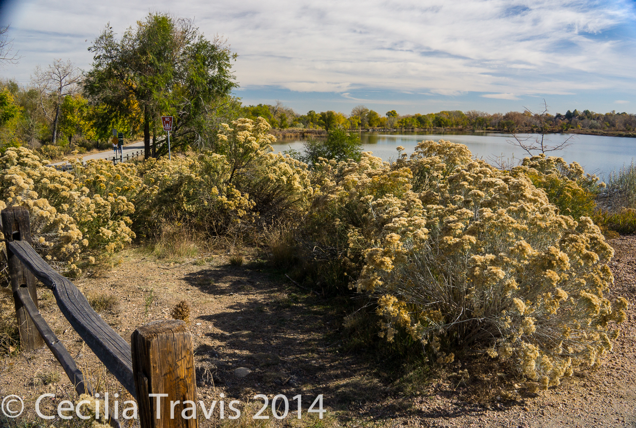
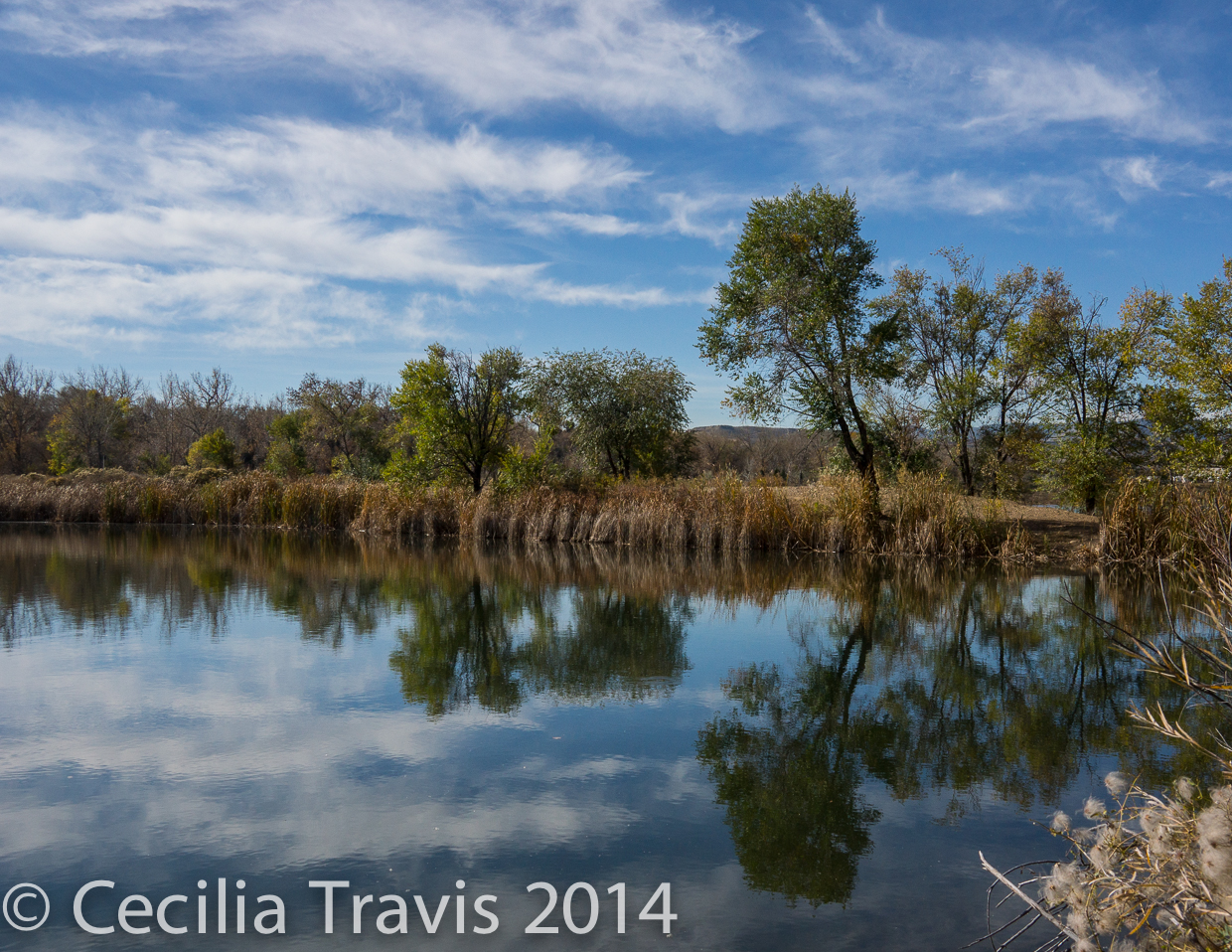
![]() The refuge is divided into two areas, both of which have accessible trails. The Prairie Management Area is open dawn to dusk all year. We went in October and were disappointed to learn that the more interesting Two Ponds area is only open May through September and then only Tuesdays through Saturdays from 8:00 a.m. to 4:00 p.m. Dogs are not allowed on the refuge. Described on National Recreational Trails site. Reviewed on Trip Advisor
The refuge is divided into two areas, both of which have accessible trails. The Prairie Management Area is open dawn to dusk all year. We went in October and were disappointed to learn that the more interesting Two Ponds area is only open May through September and then only Tuesdays through Saturdays from 8:00 a.m. to 4:00 p.m. Dogs are not allowed on the refuge. Described on National Recreational Trails site. Reviewed on Trip Advisor
Map Phone 303-289-0232

City of Wheat Ridge
City of Wheat Ridge
![]()
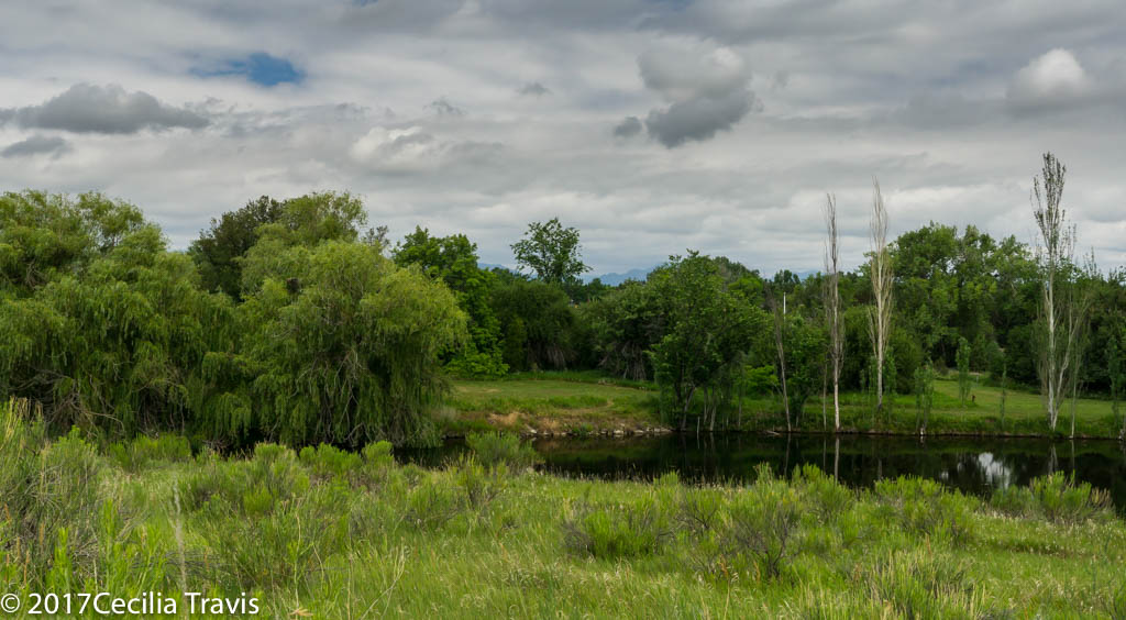
The Clear Creek Trail is flat and accessible as it runs along the creek 1.5 miles from Youngfield and 41st to just west of Kipling and 41st. There are benches and picnic shelters. We saw a coyote, a great blue heron, and beaver sign.
Loess Bluffs National Wildlife Refuge
Loess Bluffs National Wildlife Refuge
Originally called “Squaw Creek”, the refuge provides “feeding and breeding ground for migratory birds and other wildlife. The refuge includes 7,440 acres of wetlands, grasslands, and forests along the eastern edge of the Missouri River floodplain.” Map Phone 660-442-3187 Brochure Here is the Refuge website.
![]() Mike Callow Memorial Trail is “one-half-mile, out-and-back paved trail…. [which] skirts the edge of the loess hill woodlands and extends to the foothills of the loess hill. The trail starts at the visitor parking lot.”
Mike Callow Memorial Trail is “one-half-mile, out-and-back paved trail…. [which] skirts the edge of the loess hill woodlands and extends to the foothills of the loess hill. The trail starts at the visitor parking lot.”
Elephant Rocks State Park
Elephant Rocks State Park
This park, near Belleview, contains giant boulders that stand end-to-end like a train of circus elephants. They were formed from 1.5 billion year old granite. “Many of the elephant rocks lie within the seven-acre Elephant Rocks Natural Area, which is recognized for its outstanding geologic value.”
Here is the Park’s website. Phone 573-546-3454 Map Trail Map
Reviewed on Trip Advisor Accessibility
![]()
![]() The one mile Interpretive Braille Trail is “asphalt and has varying slopes and conditions. The most excessive slopes are at 9.3 percent for 37 feet and 10.2 percent for 20 feet. At some points, the trail pinches down to 28 inches wide, due to the rock formations. Along the trail are interpretive stations with Braille text.” The trail was “…especially designed for people with visual and physical disabilities.”
The one mile Interpretive Braille Trail is “asphalt and has varying slopes and conditions. The most excessive slopes are at 9.3 percent for 37 feet and 10.2 percent for 20 feet. At some points, the trail pinches down to 28 inches wide, due to the rock formations. Along the trail are interpretive stations with Braille text.” The trail was “…especially designed for people with visual and physical disabilities.”
Saint Catherine Creek National Wildlife Refuge
Saint Catherine Creek National Wildlife Refuge
Saint Catherine Creek refuge is a 24,589-acre refuge located in southwest Mississippi. It “contains a diverse array of habitat types consisting of bottomland hardwoods, cypress swamps, upland hardwoods on the loess [a type of sediment] bluffs.”Here is their website. Phone 601-442 6696 Map Brochure
![]() Magnolia Trail, a National Recreation Trail, is 8.3 miles of trails that are “a great hiking and learning experience for visitors of all ages. The trails pass through a diversity of southwest Mississippi habitats, including loess bluff hills and native wetlands. Highlights include a cypress overlook, observation deck, and photography blind. Benches along the trail provide opportunities to rest and watch wildlife. ” Map
Magnolia Trail, a National Recreation Trail, is 8.3 miles of trails that are “a great hiking and learning experience for visitors of all ages. The trails pass through a diversity of southwest Mississippi habitats, including loess bluff hills and native wetlands. Highlights include a cypress overlook, observation deck, and photography blind. Benches along the trail provide opportunities to rest and watch wildlife. ” Map
![]() Cabin Road Hiking Trail is an ATV trail used by hunters during designated refuge hunts. Off-road vehicle are only allowed on the trail at that time. that is also frequented by hikers. The 2.2 mile trail “runs along the base of the loess bluffs and through a variety of habitats, including a cypress swamp. This trail is flat and accessible to all abilities.” Better call to be sure this trail is suitable for your wheelchair, if you use one.
Cabin Road Hiking Trail is an ATV trail used by hunters during designated refuge hunts. Off-road vehicle are only allowed on the trail at that time. that is also frequented by hikers. The 2.2 mile trail “runs along the base of the loess bluffs and through a variety of habitats, including a cypress swamp. This trail is flat and accessible to all abilities.” Better call to be sure this trail is suitable for your wheelchair, if you use one.
![]() There is a 3 mile nature trail which, according to the kind person who replied to my query, varies in difficulty: “The lower section of the trail (South Trailhead) would be better suited for elderly hikers, as there is a .5 mile section (trailhead to photo blind/rookery) that is flat terrain, with one hill that has a gradual incline. If hikers went to the photoblind/rookery it would be an approximate 1 mile hike roundtrip. Along the way there is a cypress overlook, open fields for viewing wildlife, benches, a small water impoundment and a small rookery, which has an enclosed photoblind. Be aware that critters can make their way into the photoblinds, so depending on the season, check carefully for wasps, spiders and potentially snakes before entering blinds. The surface of the trail is limestone rock, so wheelchairs should also have little to no difficulty with this section of the trail.”
There is a 3 mile nature trail which, according to the kind person who replied to my query, varies in difficulty: “The lower section of the trail (South Trailhead) would be better suited for elderly hikers, as there is a .5 mile section (trailhead to photo blind/rookery) that is flat terrain, with one hill that has a gradual incline. If hikers went to the photoblind/rookery it would be an approximate 1 mile hike roundtrip. Along the way there is a cypress overlook, open fields for viewing wildlife, benches, a small water impoundment and a small rookery, which has an enclosed photoblind. Be aware that critters can make their way into the photoblinds, so depending on the season, check carefully for wasps, spiders and potentially snakes before entering blinds. The surface of the trail is limestone rock, so wheelchairs should also have little to no difficulty with this section of the trail.”
Mingo National Wildlife Refuge
Mingo National Wildlife Refuge
Mingo NWR encompasses 21,592 acres and lies in a basin formed in an ancient abandoned channel of the Mississippi River in southeast Missouri.
Here is the Refuge website. Phone 573-222-3589
![]() Swampwalk Nature trail: described in Wikipedia: ” a one-mile (1.6-km) loop trail through the bottomland hardwood swamp. A self-guided pamphlet of the trail is available at the Boardwalk parking lot. The path is wheelchair accessible.” The refuge’s website does not state that the boardwalk is wheelchair accessible, but says the trail “… meanders 0.8 miles through the bottomland hardwood forest. Observation decks at the Monopoly Overlook, Rockhouse Marsh, and Red Mill Drive, offer outstanding views of the Mingo Basin and its wildlife.” You might want to call ahead to be sure of the accessibility.
Swampwalk Nature trail: described in Wikipedia: ” a one-mile (1.6-km) loop trail through the bottomland hardwood swamp. A self-guided pamphlet of the trail is available at the Boardwalk parking lot. The path is wheelchair accessible.” The refuge’s website does not state that the boardwalk is wheelchair accessible, but says the trail “… meanders 0.8 miles through the bottomland hardwood forest. Observation decks at the Monopoly Overlook, Rockhouse Marsh, and Red Mill Drive, offer outstanding views of the Mingo Basin and its wildlife.” You might want to call ahead to be sure of the accessibility.